Once we wrapped up with Mochi and Kim in Colorado Springs, it was time to begin our trip back east.
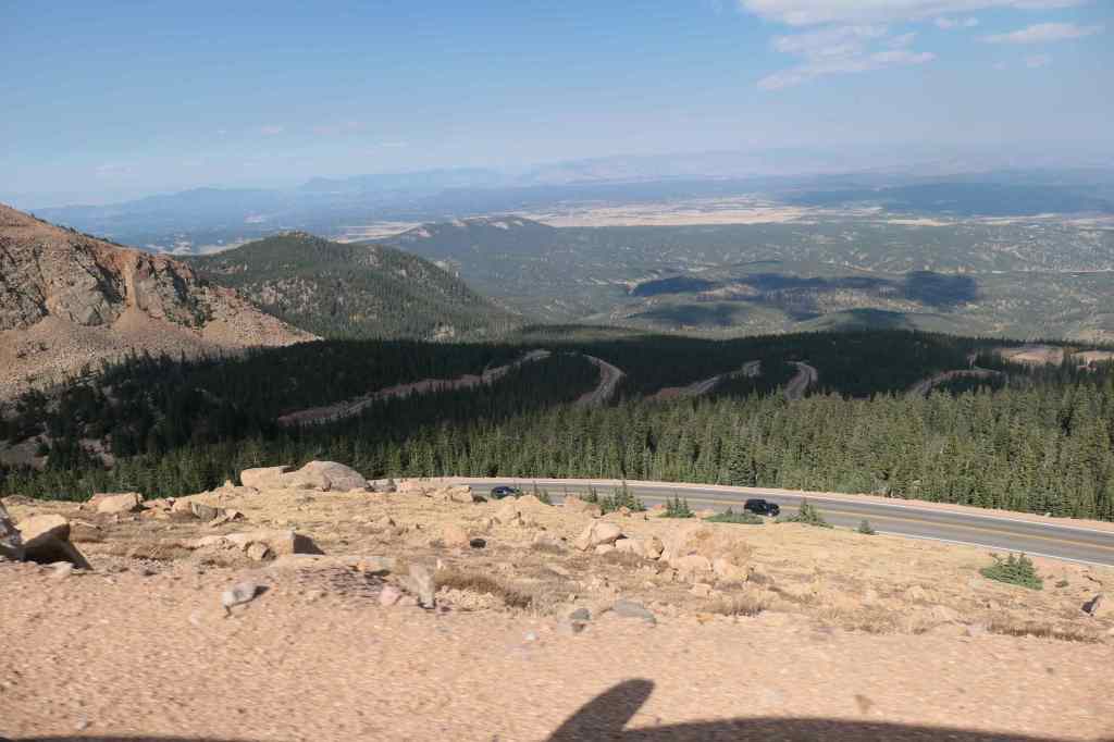
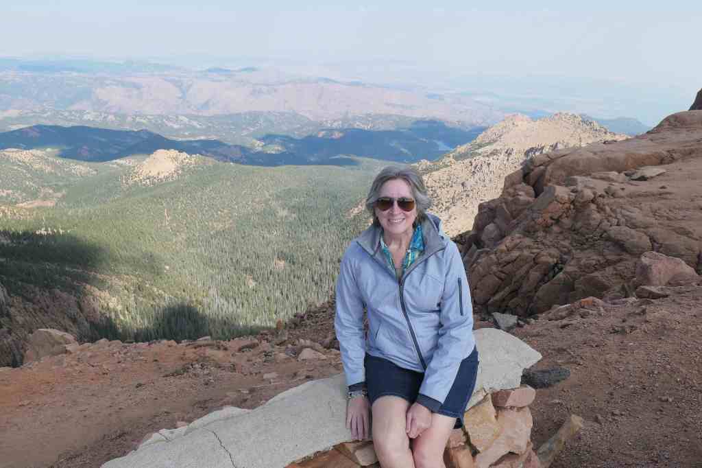
Before we could leave Colorado, however, we wanted to make the drive to the summit of Pike’s Peak. Had to check out the view from the top!
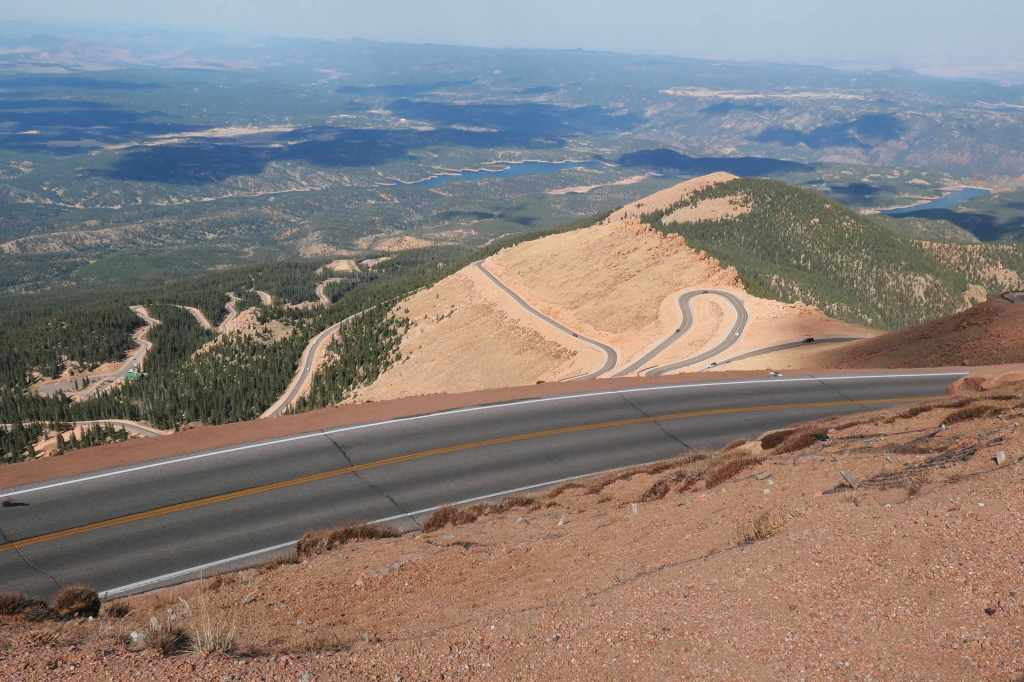
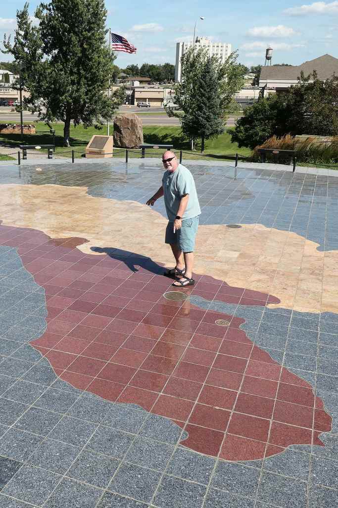
Pikes Peak is the most well-known of the “fourteeners” (mountains over 14k ft tall). Of the 96 in the US, 58 are in Colorado! And at 14, 115 ft, Pikes is only the 30th tallest in the state. Wow!
From the entrance gate of “America’s Mountain,” we began our ascent among the switchbacks.
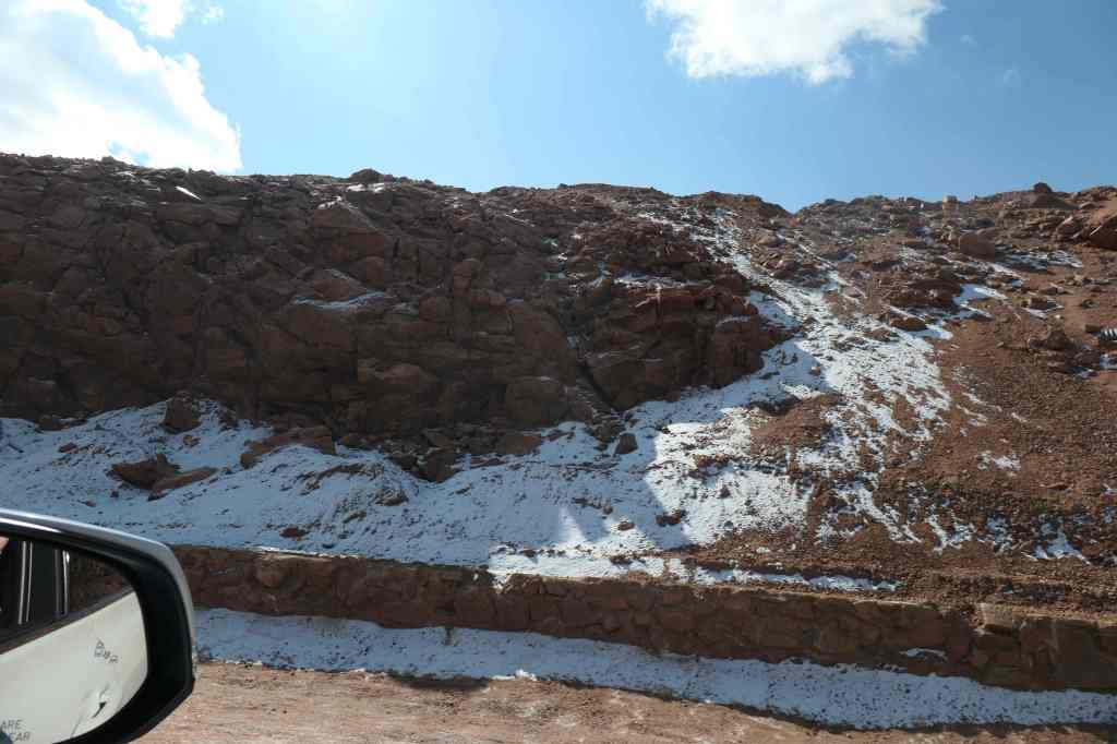
The drive twisted up & up, looking w-a-a-y down from where we started…We continued up & up, past the tree line,and past the snow, to the summitwhere the view was spectacular!
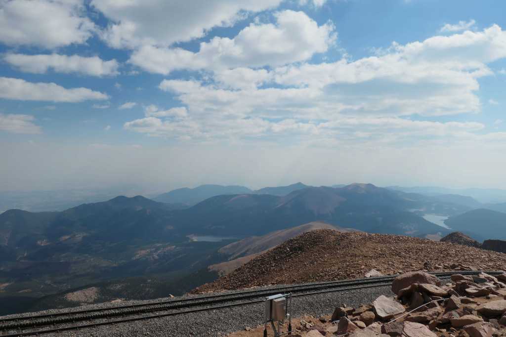
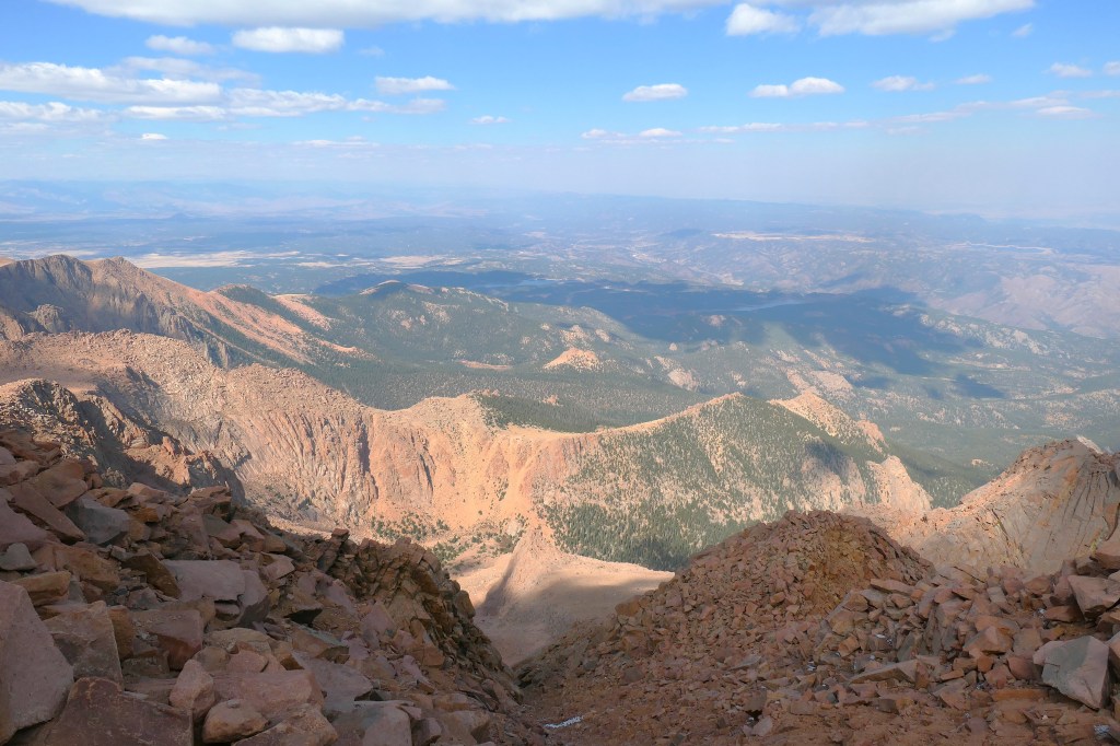
At the top, we donned jackets against the 30-degree temperature change, stepped out of the car and realized catching one’s breath at 14k feet is no easy feat! Once we did so, we could enjoy the breathtaking scenery and the world-famous donuts, made since 1916 with a special recipe to combat the thinner air and less pressure.
Stunning viewsOne more pause along the wayBack down the mountain
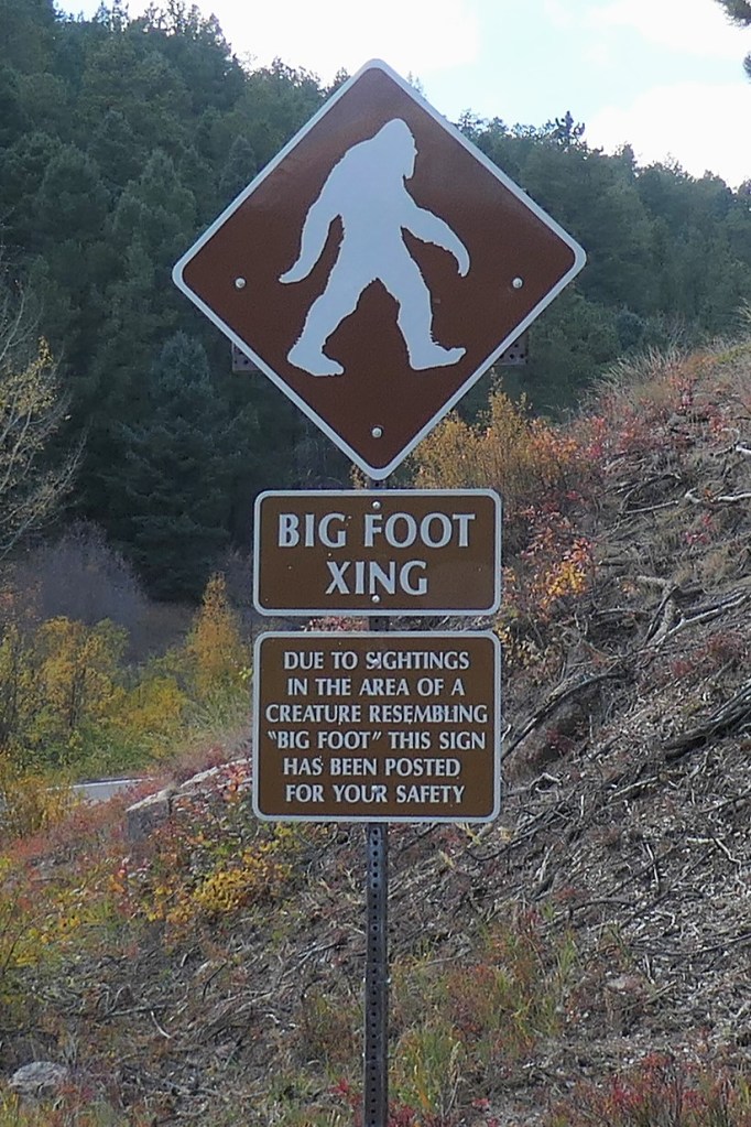
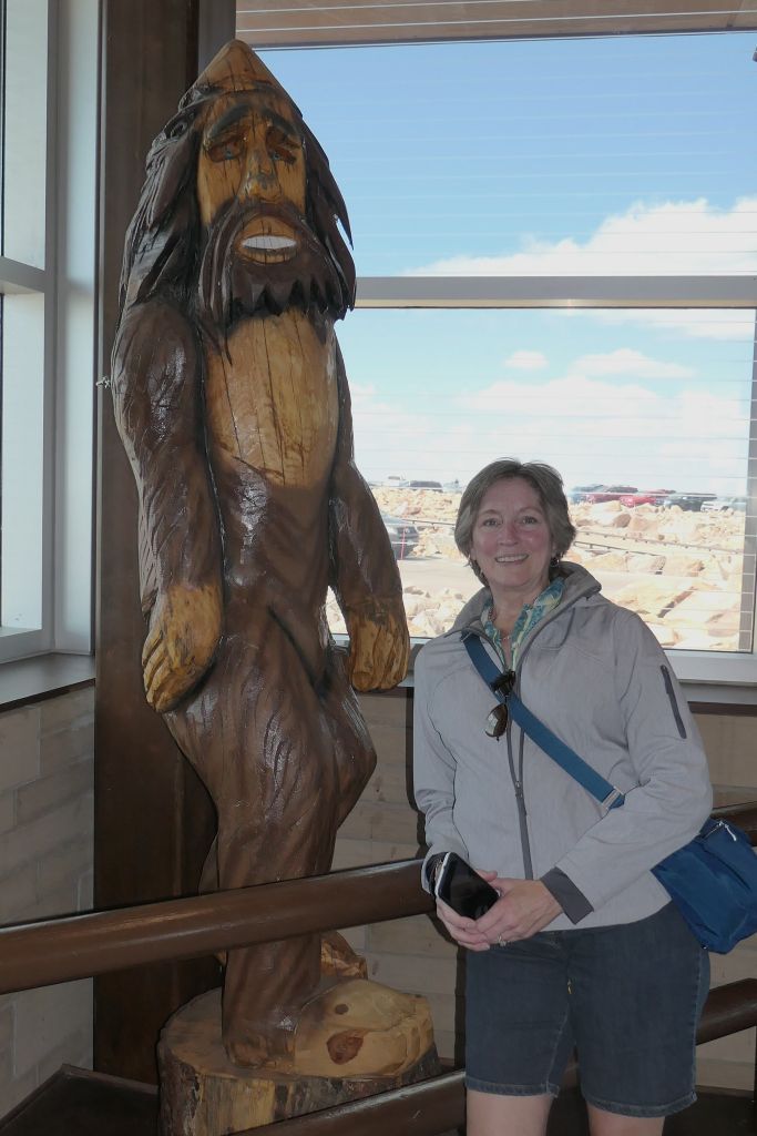
For big brother Mike, yes, there are rumors of Big Foot, even way out here. 🙂
Despite the warnings, however, we did not spot Big Foot on the drive.We found him in the Visitor Center! (Hoping for donuts, perhaps?)
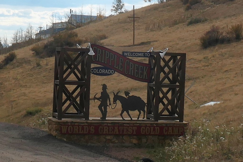
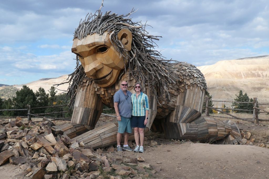
Hard to top that, right? But we had to move on, so we wrapped up departure day by driving through the mountains and the big gold mining area of Cripple Creek, the largest in Colorado, with more than 23 million ounces recovered from the district since 1890. But no, “we ain’t there to see gold.” We planned to visit another of Thomas Dambo’s trolls. Why, might one ask? Because her name is Rita! Rita the Rock Planter. Having been introduced to the Danish artist’s trolls outside Louisville, Kentucky in May when we visited the Forest Giants at the Bernheim Forest and Arboretum, we couldn’t pass up Rita.
Cripple Creek, ColoradoRita tends the earth near the gold mines in Victor, Colorado
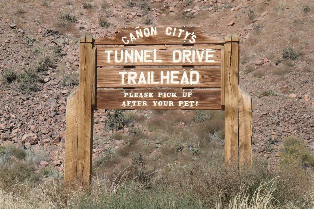
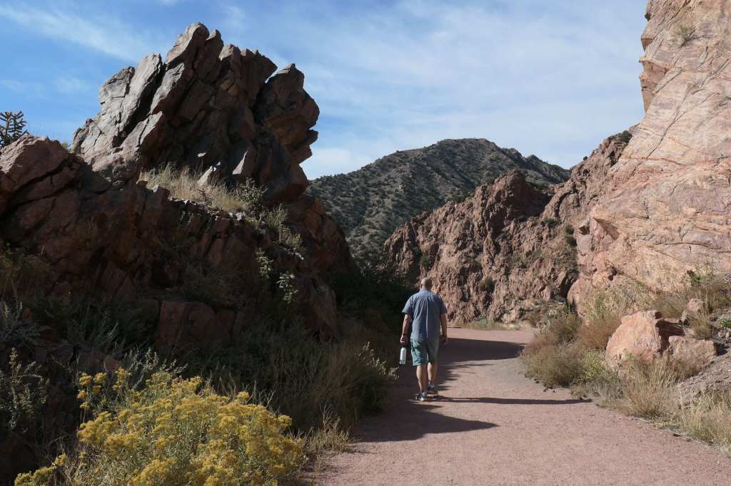
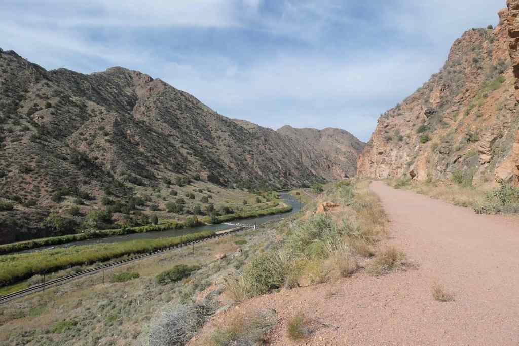
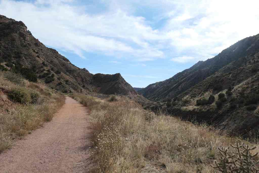
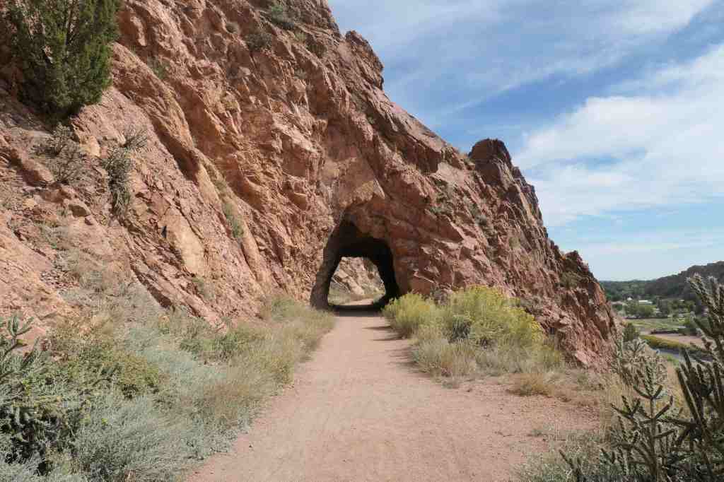
The next morning, before hitting the road, we hit the trail to take in more Colorado views.
From Wiki – “The trail was originally the site of a wooden irrigation canal that also supplied water to Cañon City. It was built in the late nineteenth-century… and the city stopped using the canal in 1974.”
The trail was well-keptand the view, fabulous!Per the name, there were several old tunnels, one quite longand two short
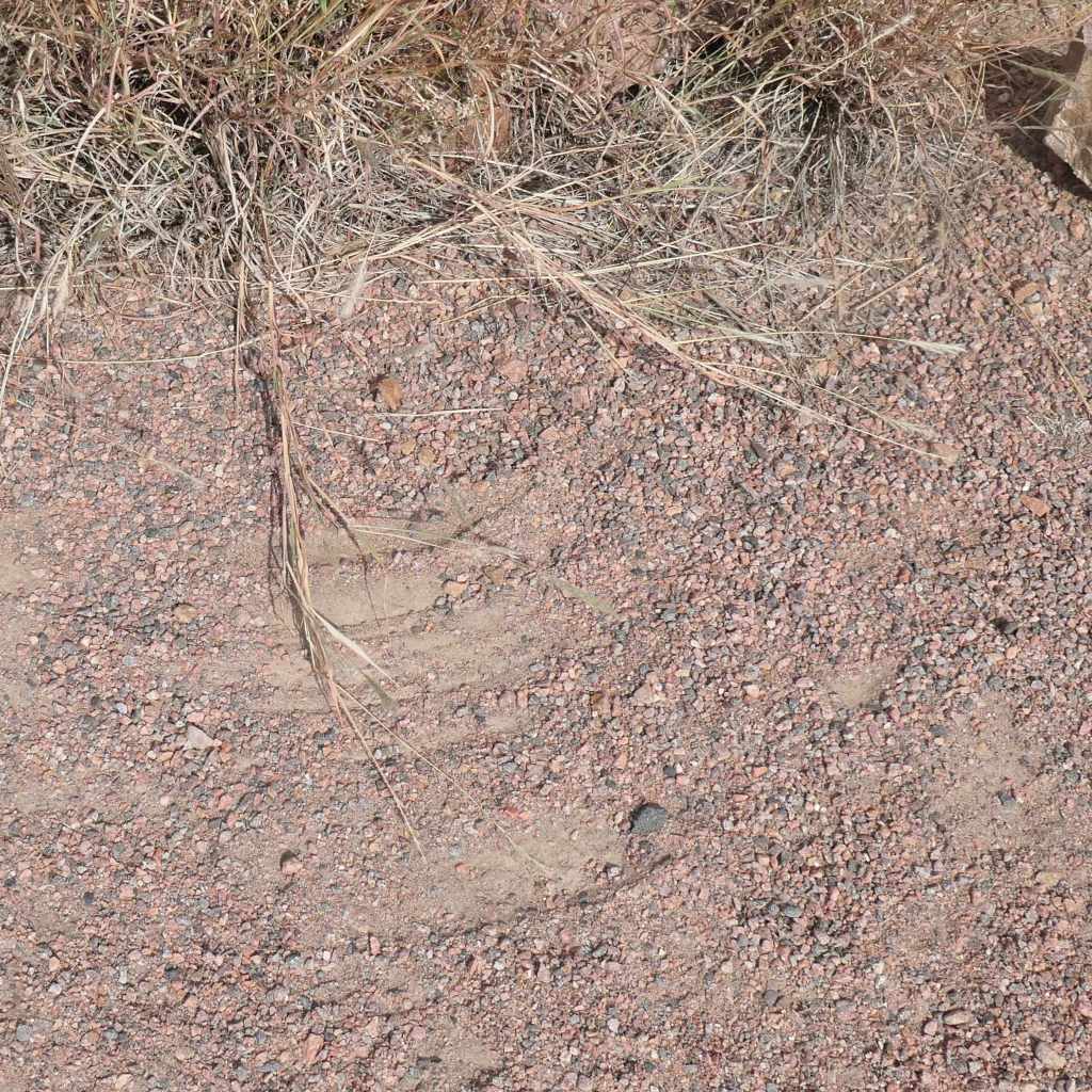
We noticed a fascinating thing along the trail. Blown by the almost constant wind, some of the plants are trying to sweep away the mountain!
Great job!Looking goodKeep working – you can do it!
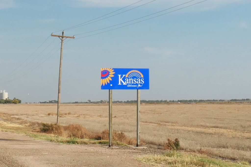
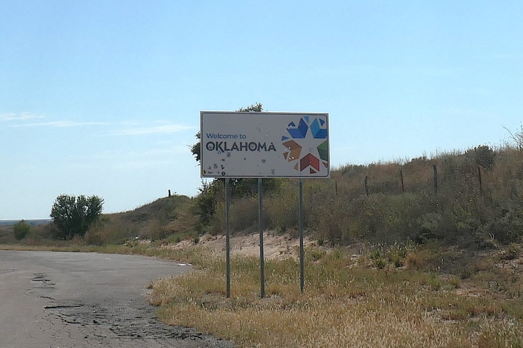
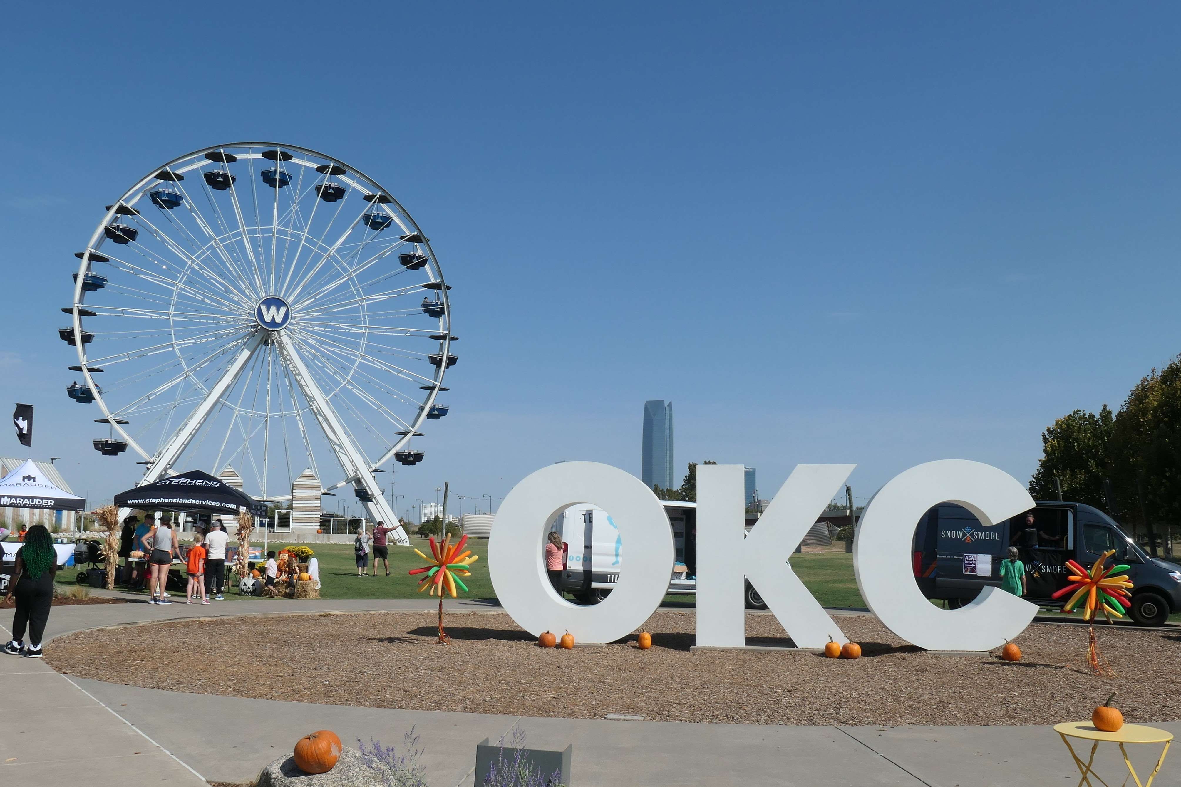
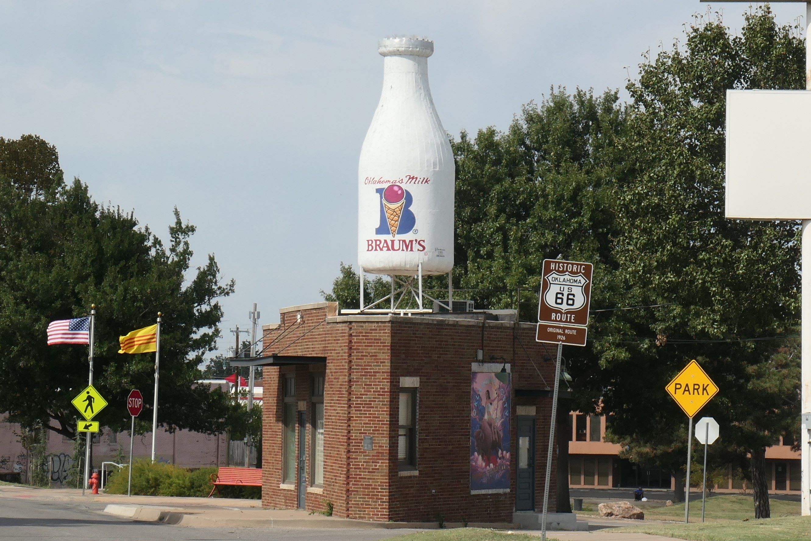
After our morning walk, we were off on the week’s road trip, during which we checked off three more states: Kansas, Oklahoma, and Texas!
Welcome to KansasWelcome to Oklahoma – think nothing of the buckshotWelcome to friendly Texas, at last!
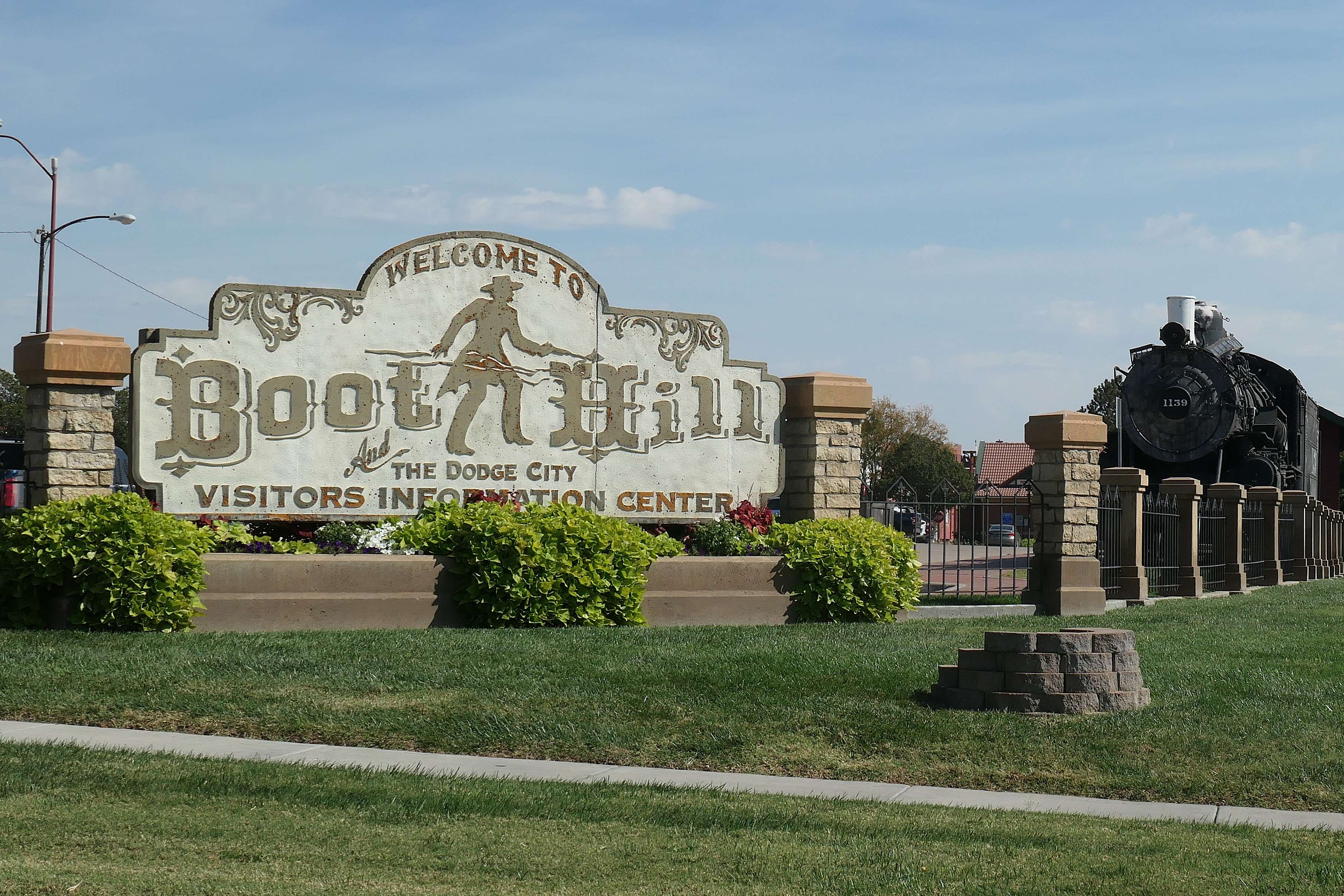
We didn’t hustle, and needless to say through the miles of mostly flat cow country and dozens of giant feed lots, we still paused for a few touristy highlights. (It’s what we do. 😉 )
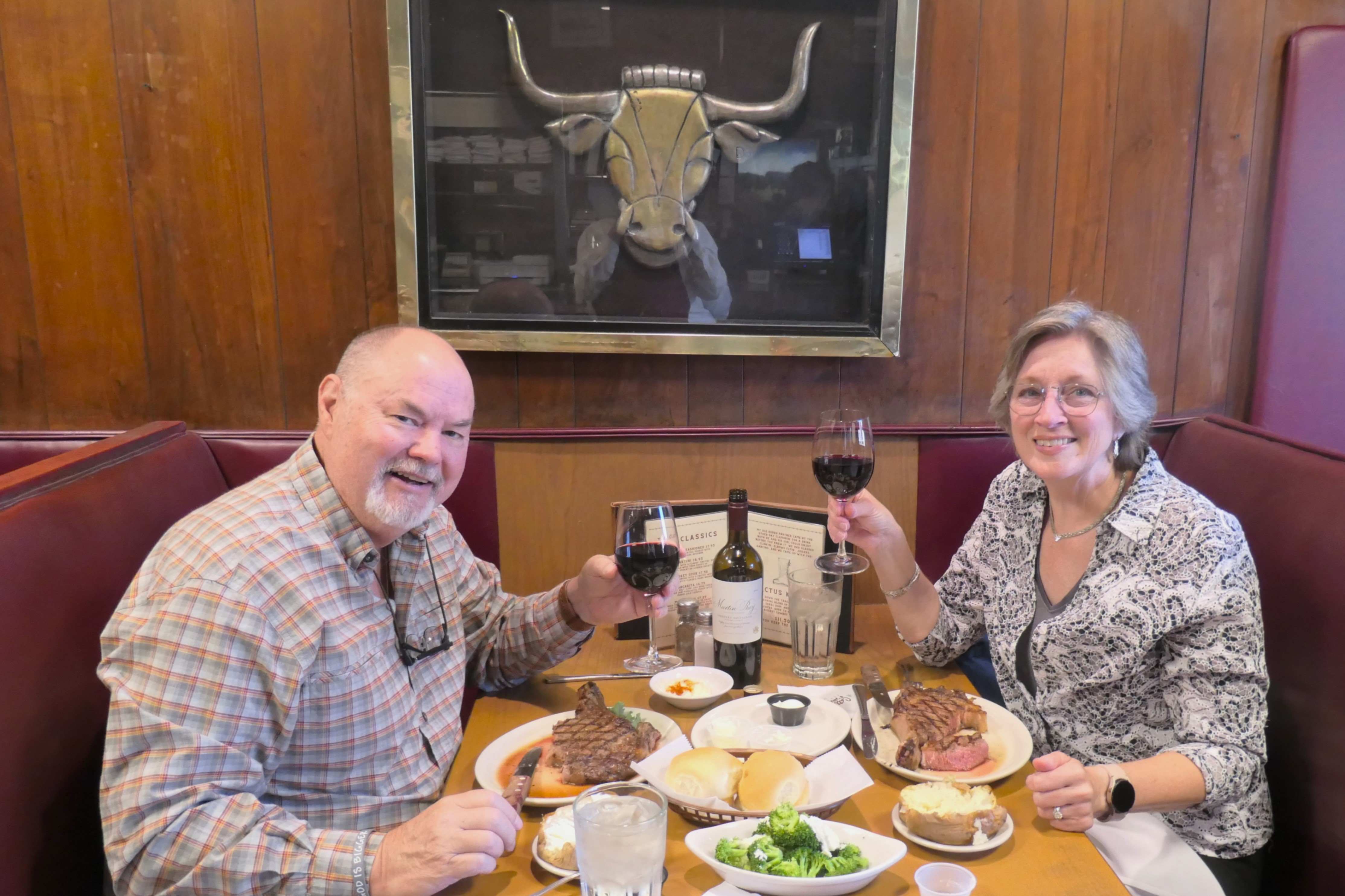
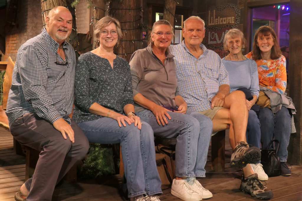
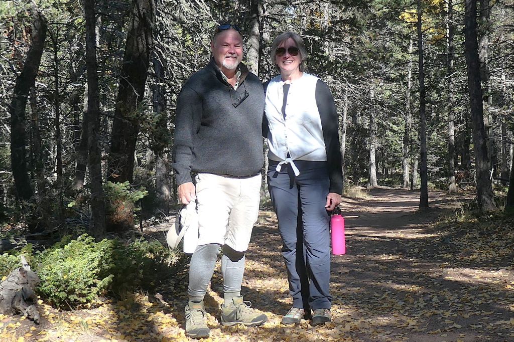
On this leg of the journey east, the goal was to meet up with friends Terry and Lynn. Wherever we’ve been in our travels, we’ve found that Texans are proud of their state, and they are no exception, gladly showing off their piece of paradise.
With Lynn, Terry, Barbara, and Shawn
Thank you, Terry & Lynn, for the warm welcome to Longview and introduction to Ms. Barbara and Shawn. It was a pleasure!
After the slight timeout for Todd to sacrifice a “spare part” (apparently the gallbladder isn’t all that essential), we made it to Colorado Springs, and the house/pet-sitting finally began. Yes! We spent a month in scenic Colorado Springs, where Kim’s lovely home is situated on a mesa (flat mountain) with gorgeous views in all directions.
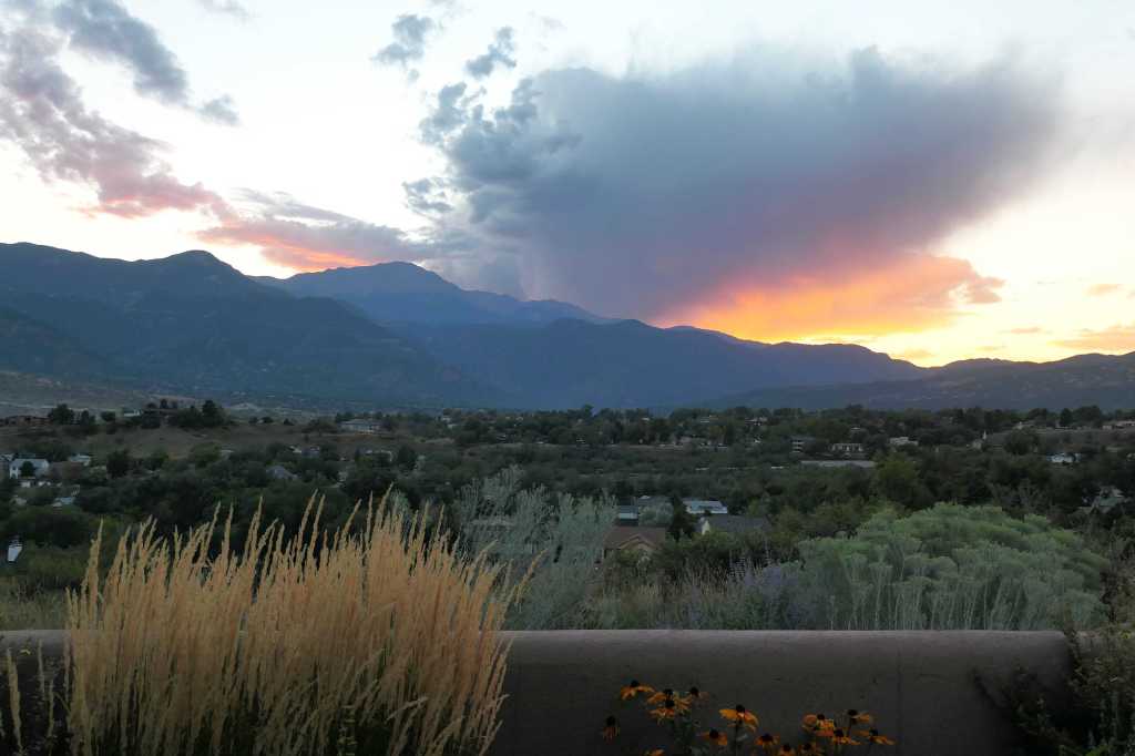
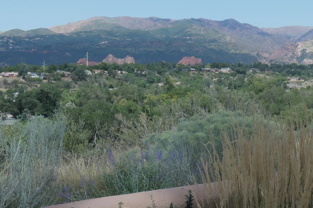
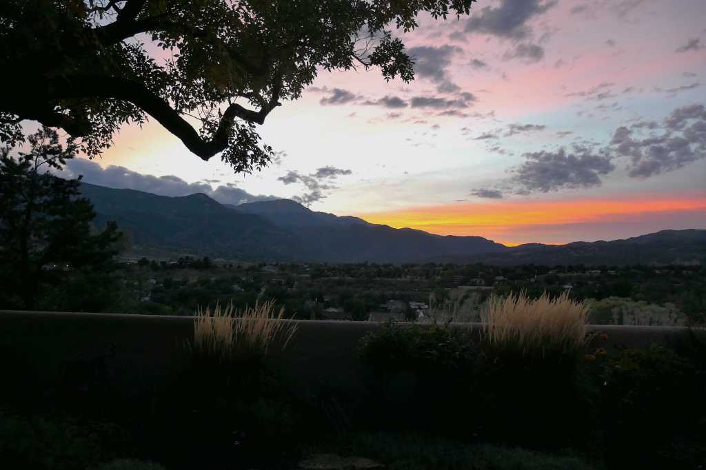
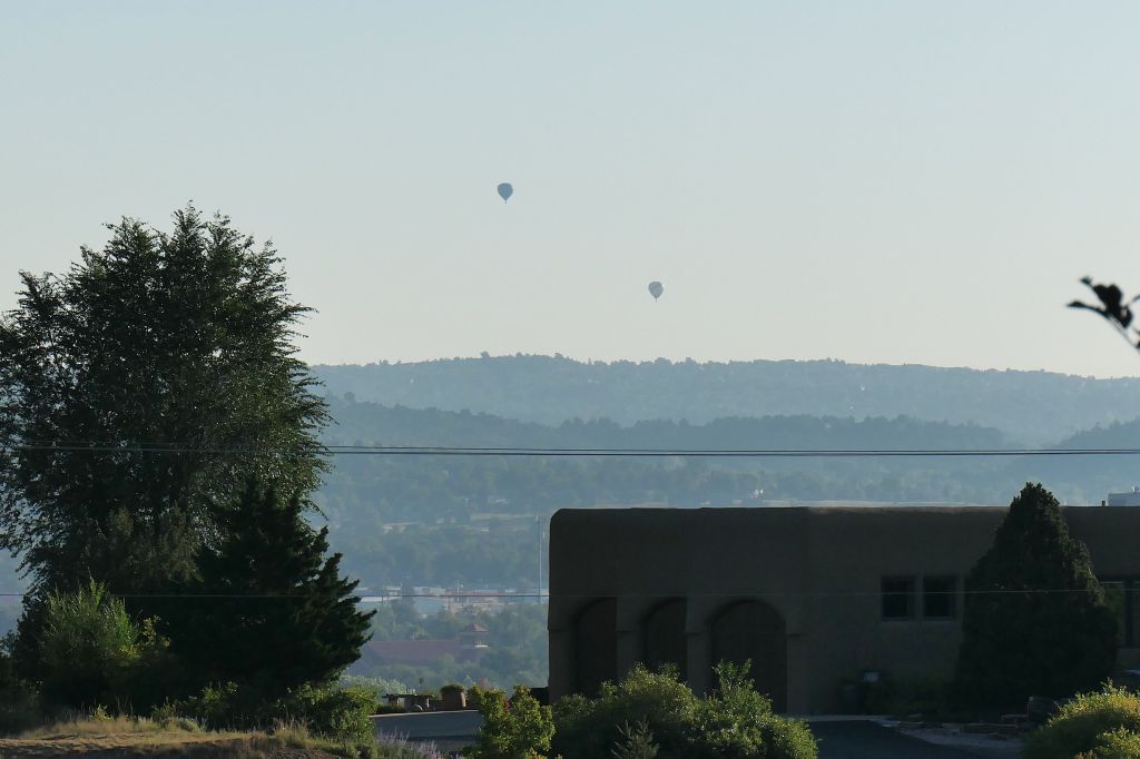
One’s perspective changes here. At 6,000 feet, Colorado Springs is higher than the famous “Mile High City” of Denver and heck, we are higher than just about all the mountains in the east! And from here, the long line of amazing mountains in the distance soars another 6,000 to 8,000 feet above you for miles on end. One wonders about those pioneers that didn’t just stop but instead found a way through! Heck, it’s Sept/Oct and we’ve already seen snow on the top of Pikes Peak from here.
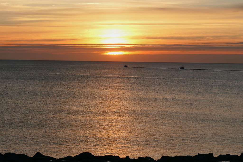
Pike’s Peak at sunsetNearby Garden of the Gods (those upright jagged rock formations)A cloudy sunsetFrom the back courtyard, there’s a stunning view of the Front Range of the Rocky Mountains. That’s 10 miles away!
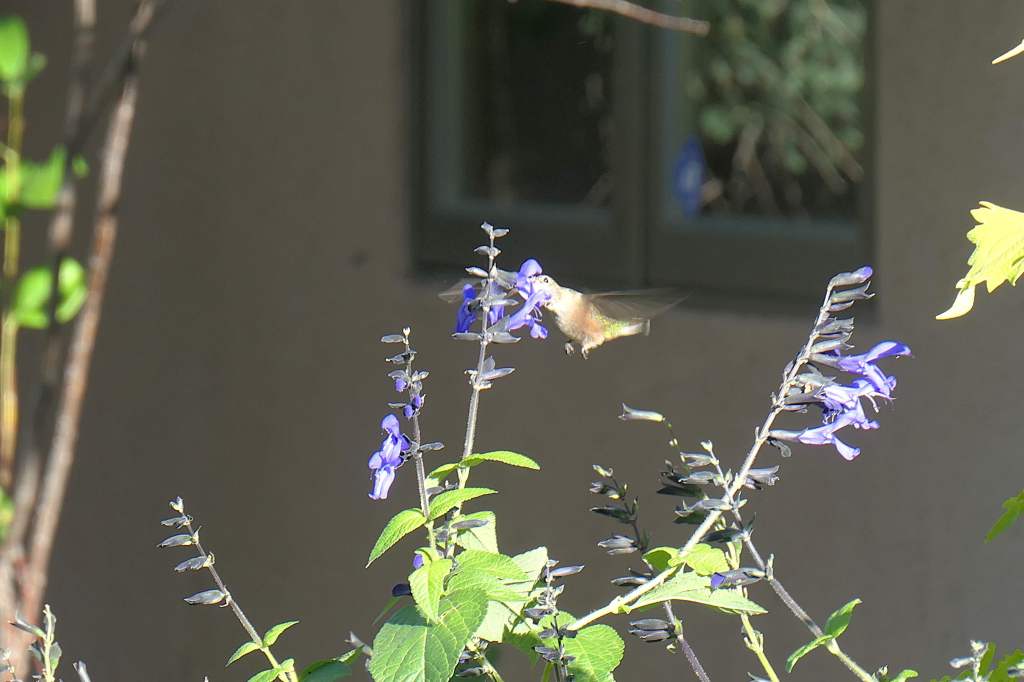
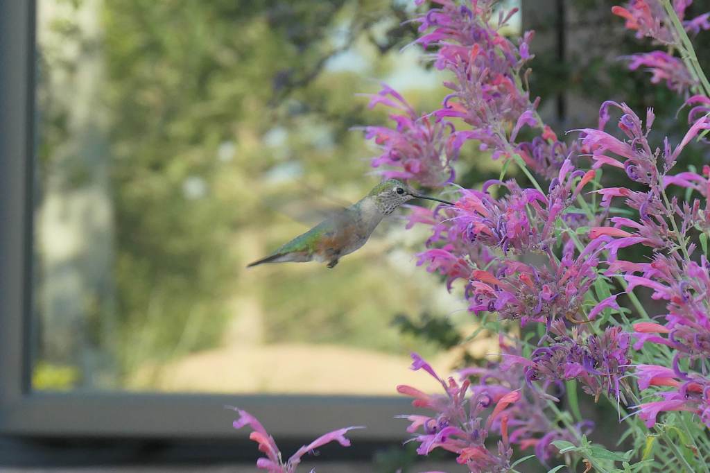
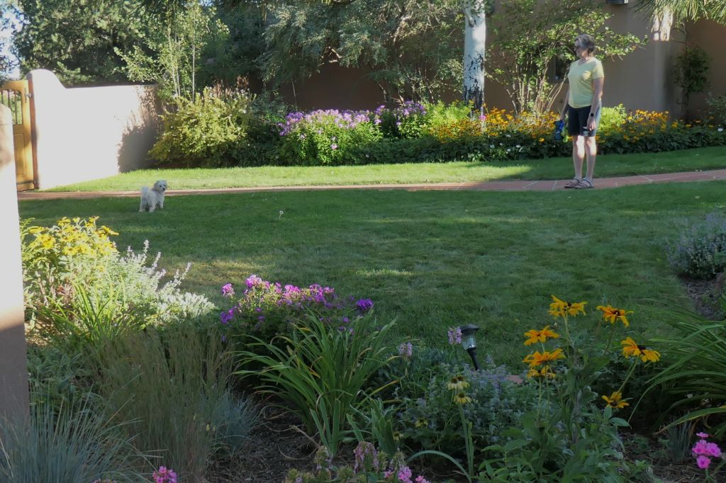
We could also peer out at the mountains in the other direction while enjoying the pretty landscaping in the front courtyard, where the brave hummingbirds entertained us with their antics among the flowers.
Early morning hot air balloons in the distanceThese guys had no fearOften hovering right next to the photographer!
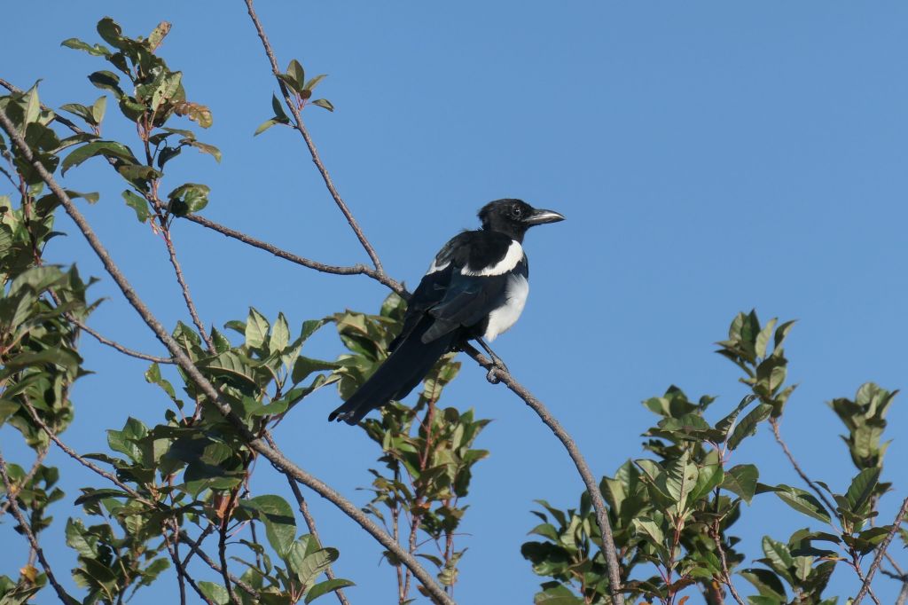
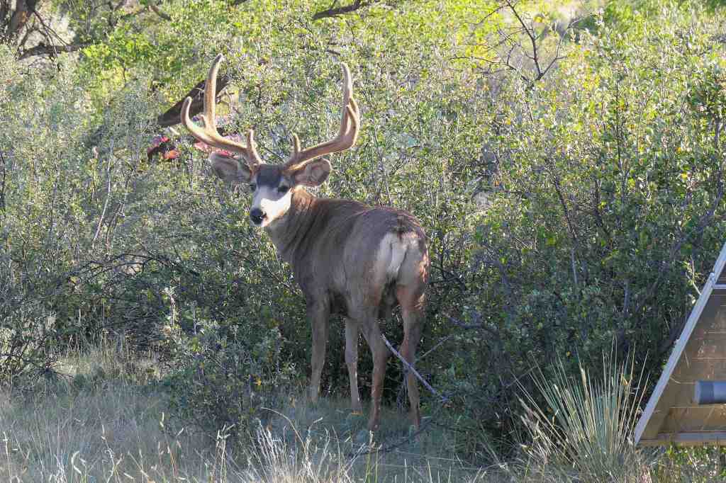
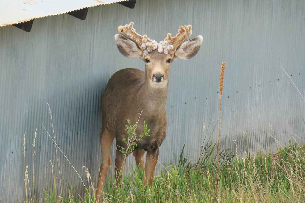
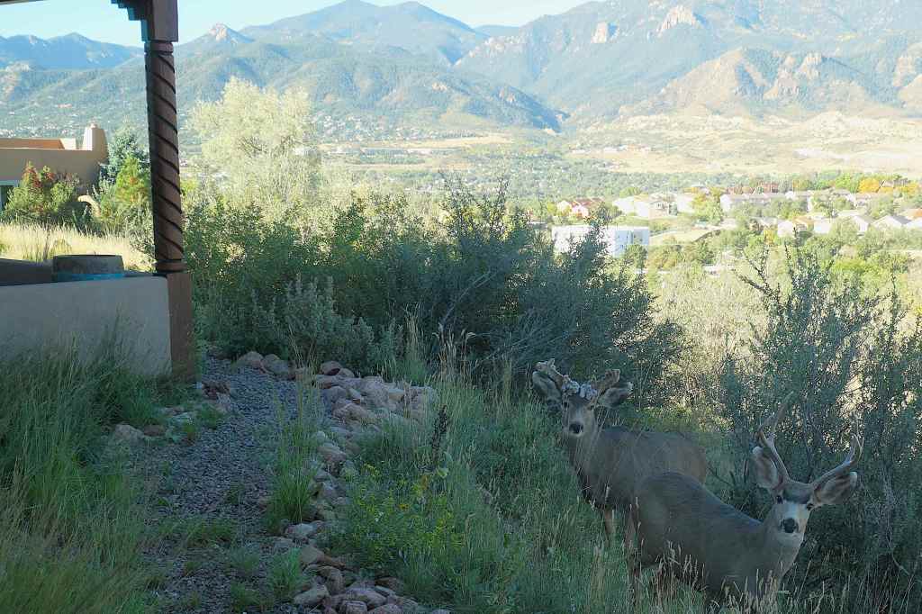
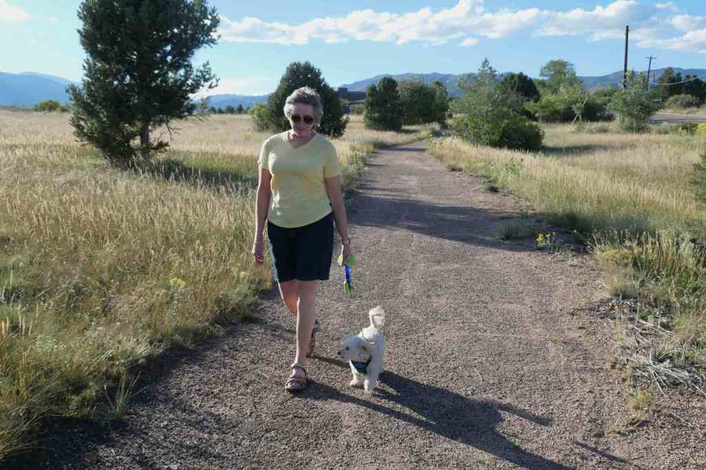
On our daily walks with Mochi, we enjoyed sharing the mesa with the Magpies and several large-eared mule deer who call the area home.
Black-billed MagpieStanding 15′ from the biggest rack we’ve seen NOT on a wall “What?“We discovered this buck just down the hillNot sure what’s up with his antlers Sorry, Dude
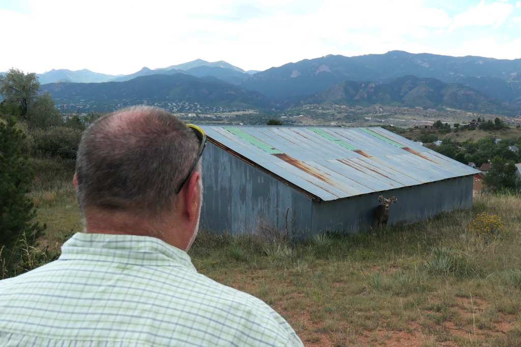
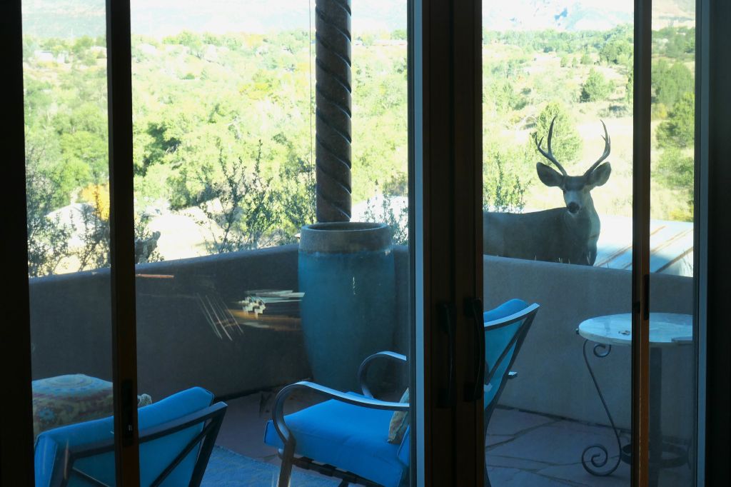
Like the hummingbirds, the mule deer were seemingly unafraid. In fact, we didn’t really have to go for a walk to find them. They’d find us, stopping by to look in the bedroom or sunroom windows.
“Hello, I know you’re in there. I can hear you.“Buddies?
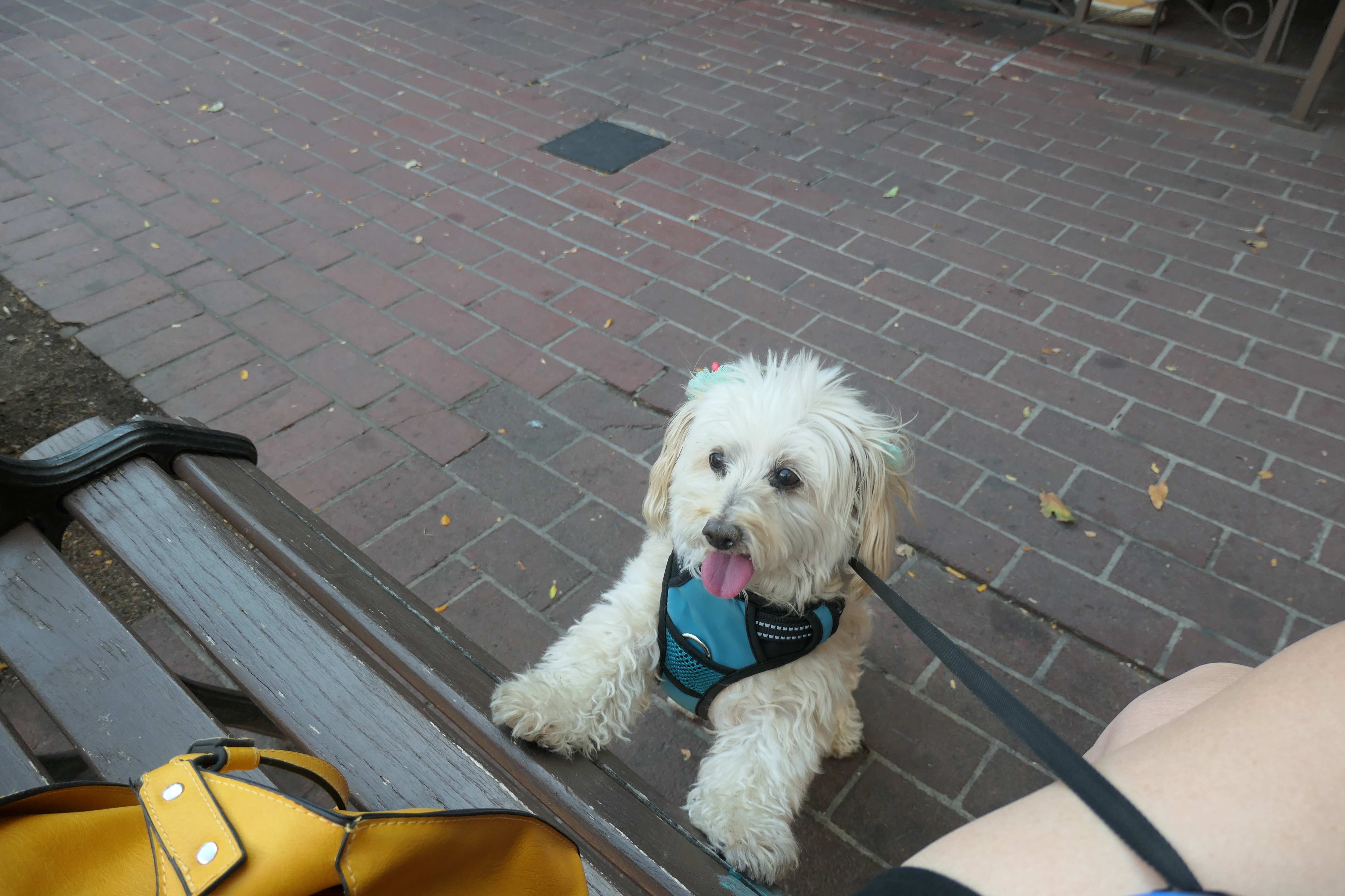
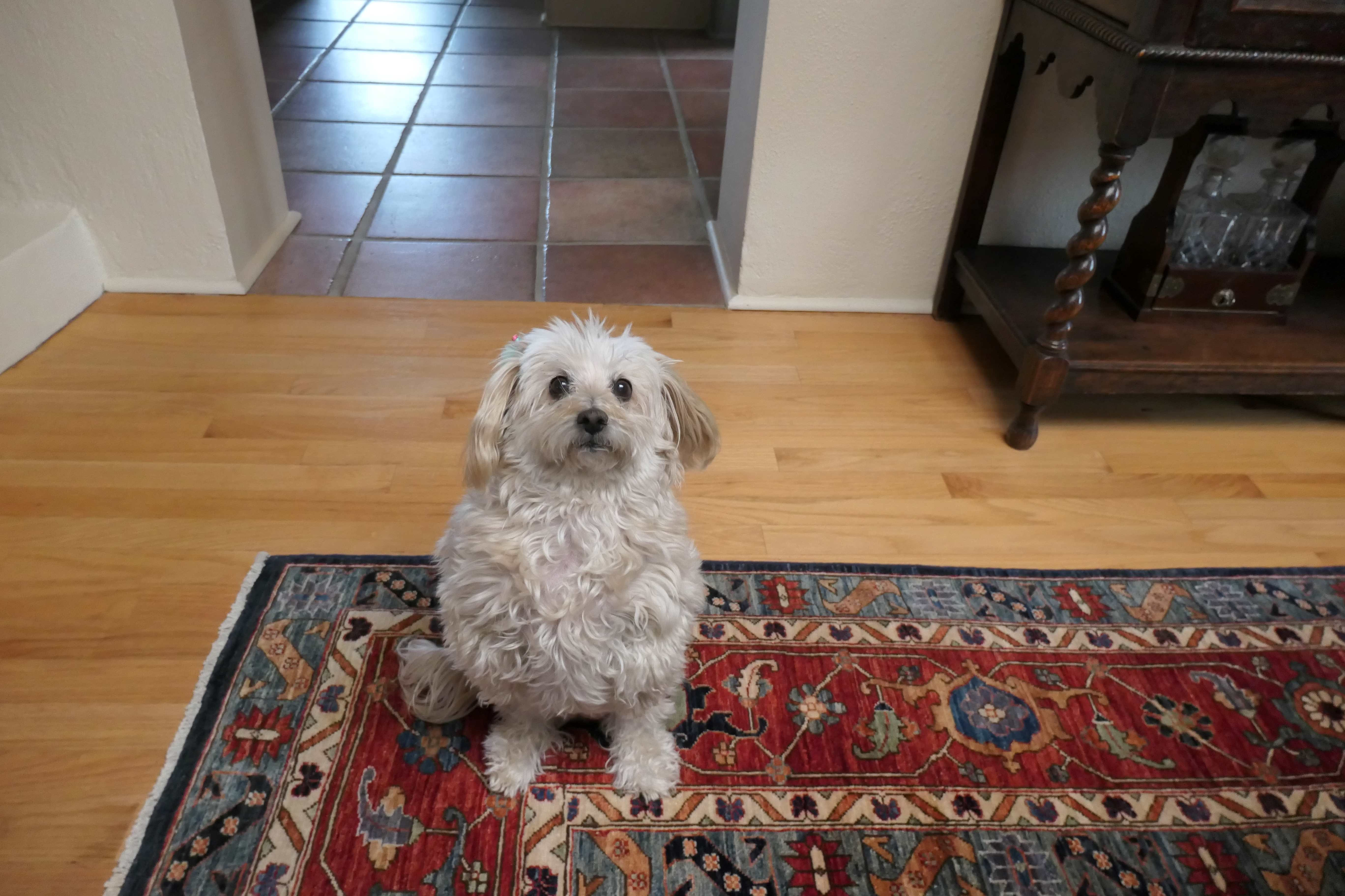
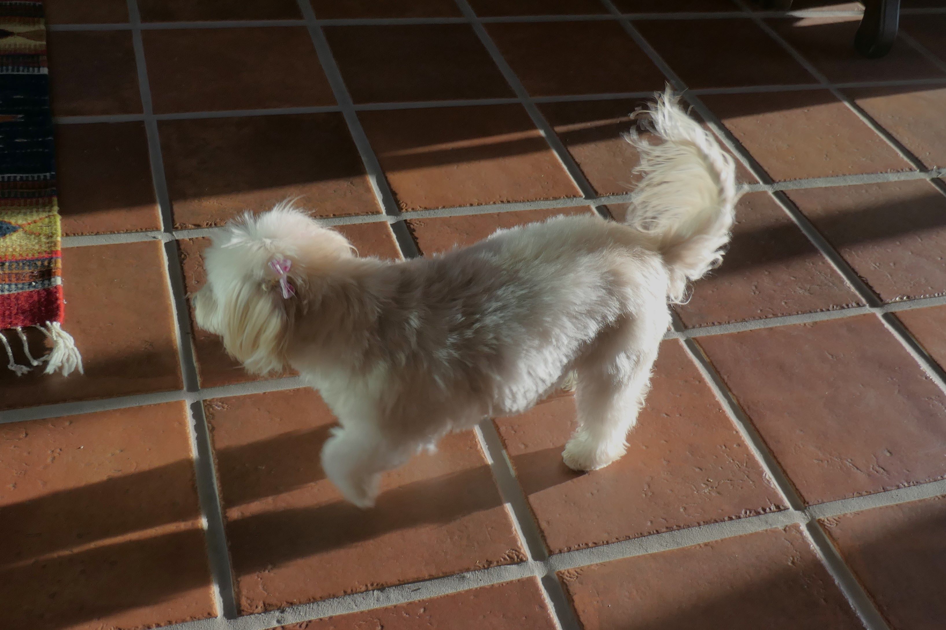
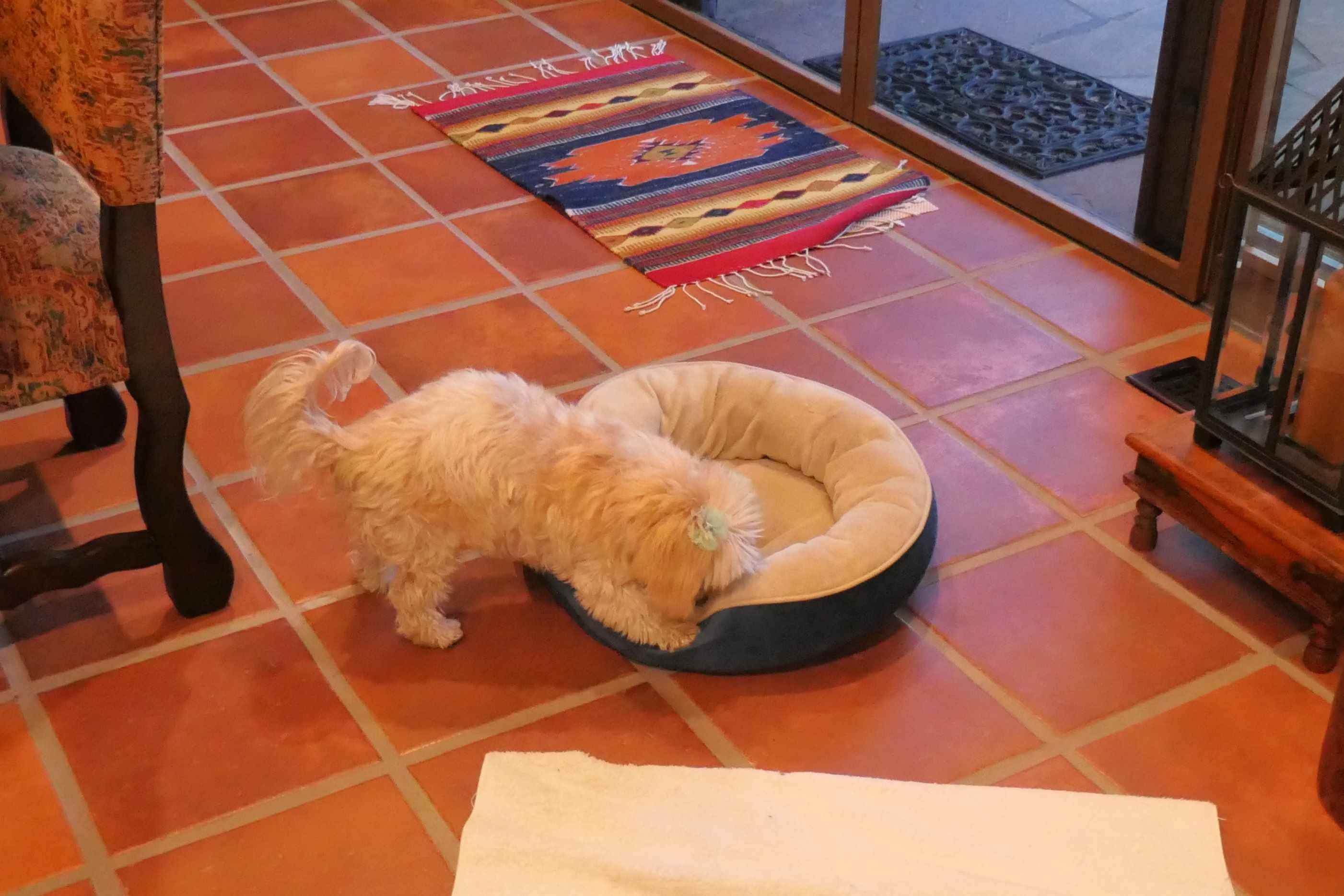
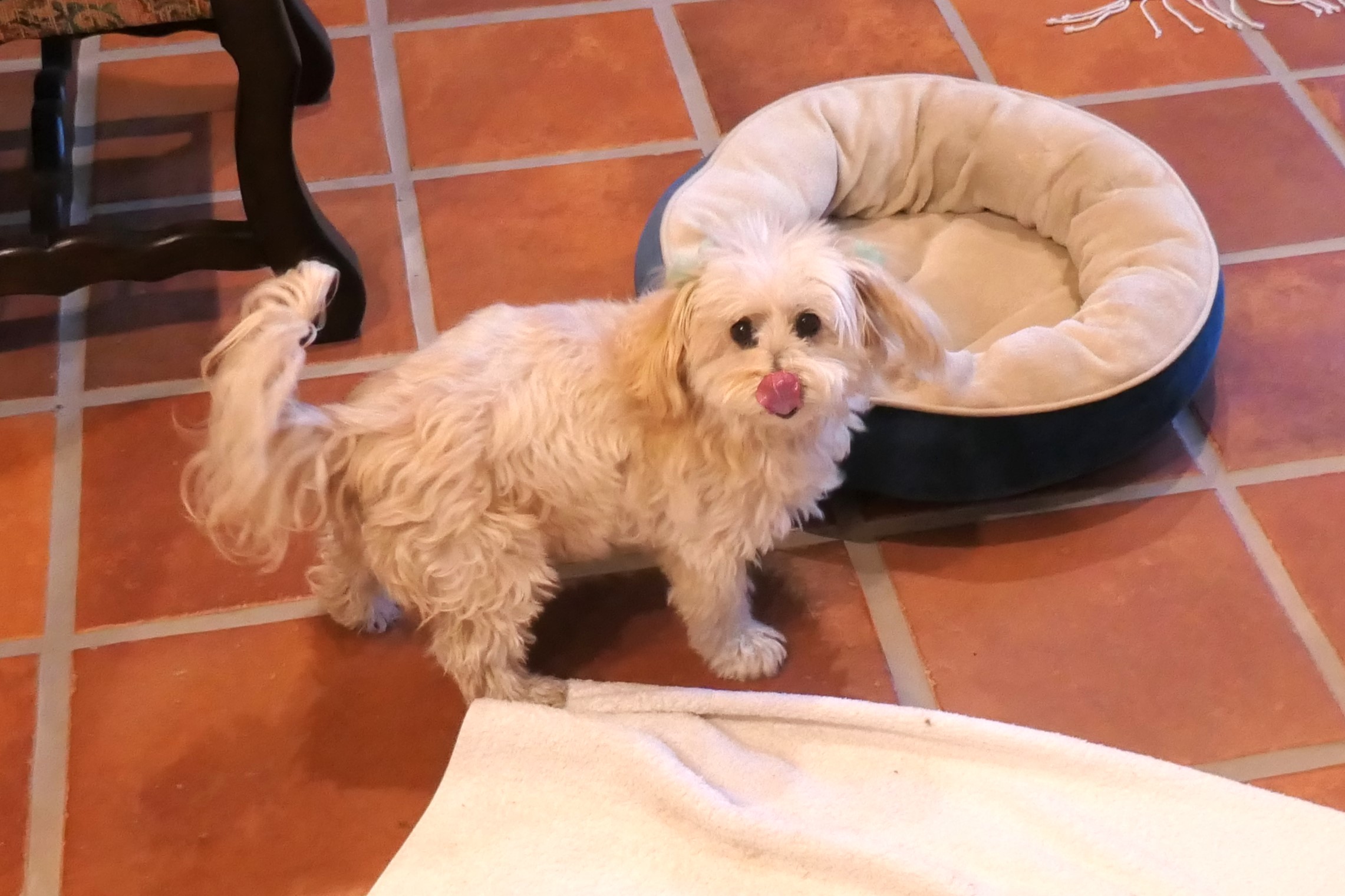
So, back to just what is a Mochi. Well, in this instance it is an adorable 12-pound ball of loveable furriness, not a sweetened ball of Japanese rice.
We’ll let the pictures speak for themselves:
Too cute, right? 🙂
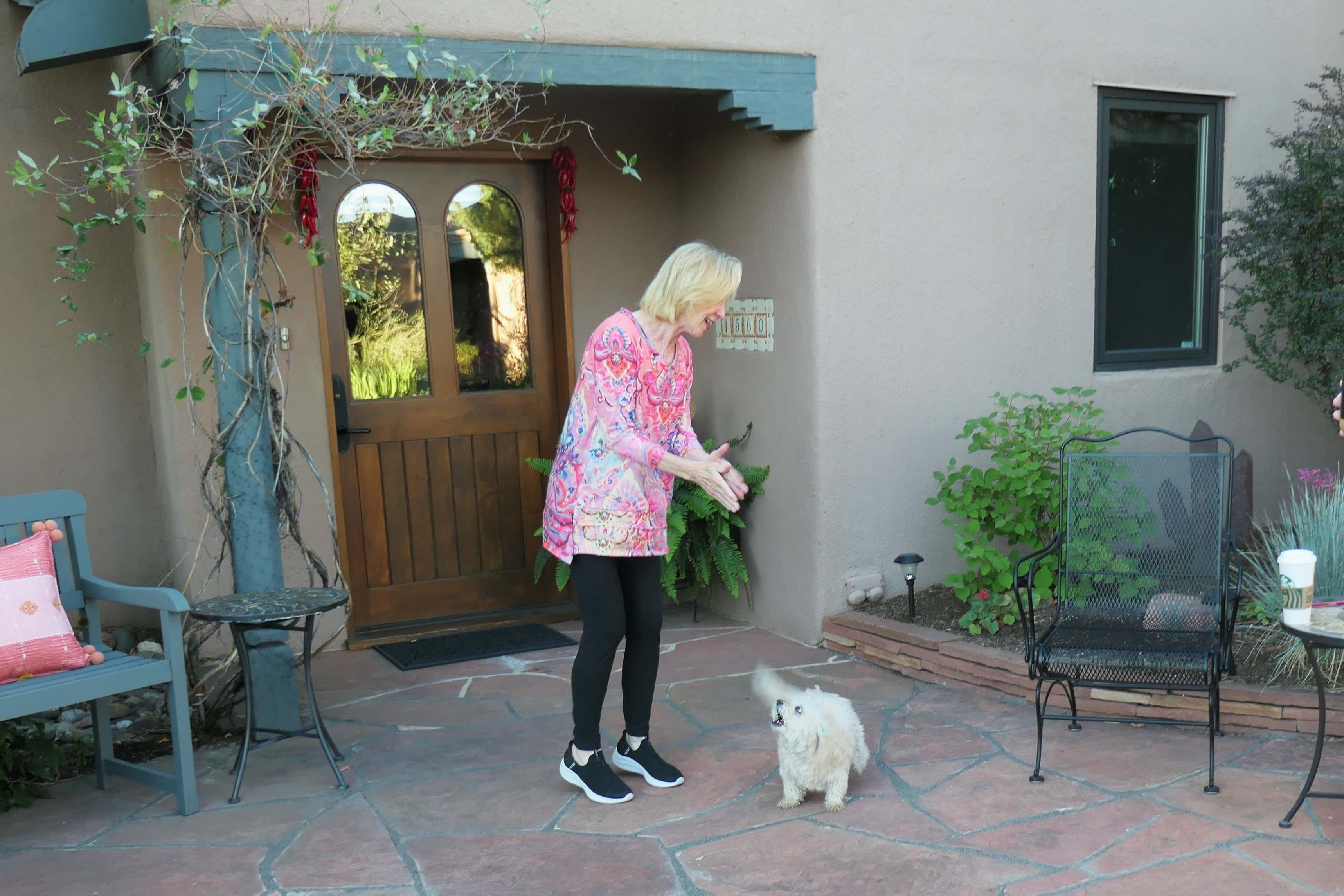
Once she got back home, Kim – with Mochi glued to her side lest she disappear again – insisted we not miss the splash of Colorado fall color and shooed us out of the house to visit Mueller State Park. Off we went. Water bottles? Check. Hiking boots? Check. Something warmer than shorts & summer shirts? O-o-o-o-ps.
It was nearing 80 degrees in Colorado Springs but in the mid-50’s up on the mountain, and our jackets were at the house, 45-minutes away. Fortunately, Todd remembered the small vacuum-packed bag of winter clothes still in the car. A quick change in the restroom and we were ready to hike… with long johns hanging out from under our summer attire. Oh well, you do what you gotta do. 🙂
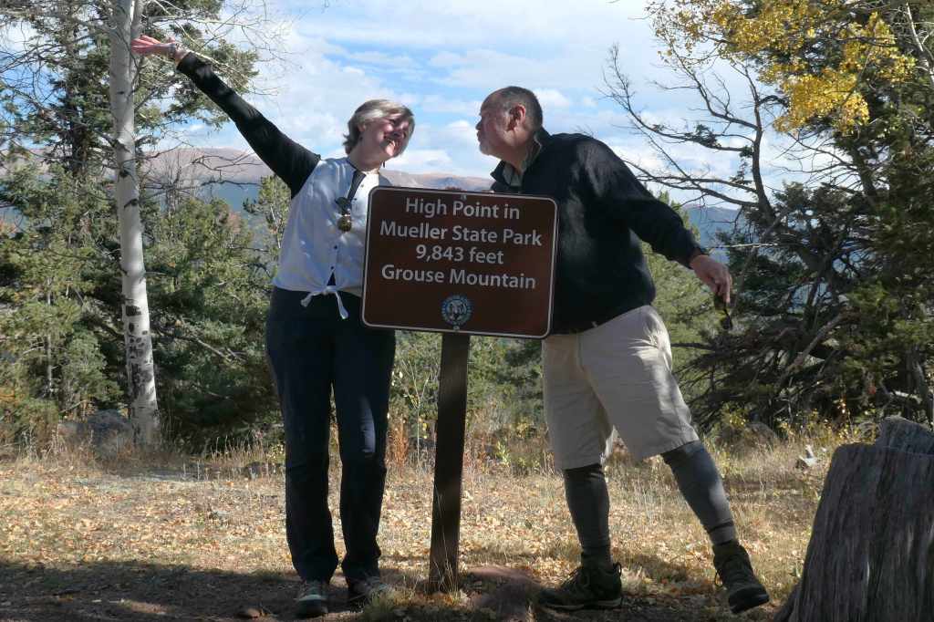
Sporty outfitsView along the trail to the topDancing? Or perhaps the altitude?
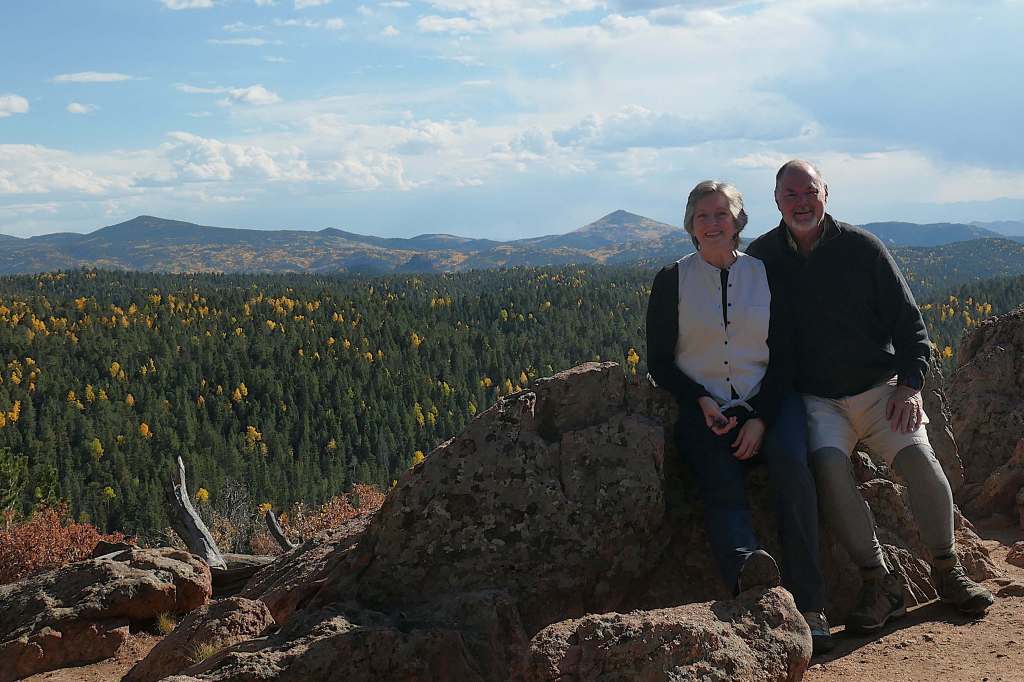
After the celebration dance at the top, we continued on, as advised by the kind woman at the visitor center, who promised a fabulous view from the ridge. Or perhaps she was just trying to get rid of the goofy looking tourists…?
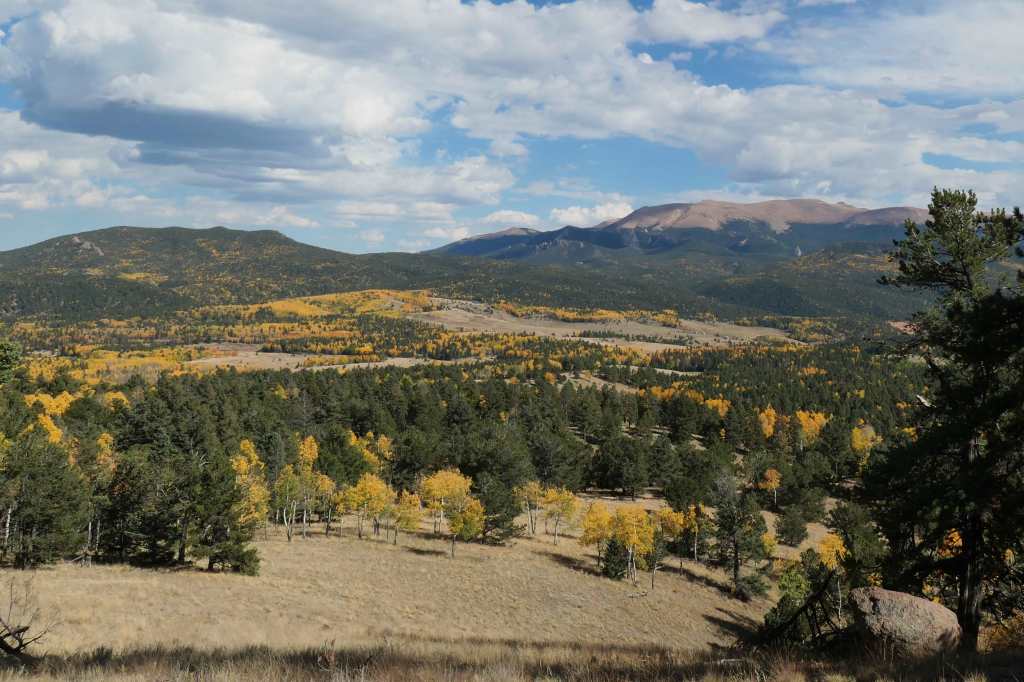
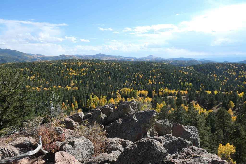
Pretty stunningPops of yellow among the evergreens as far as we could seeIt’s the Aspens that make the fall color here, as they turn bright yellow – Todd’s favorite!
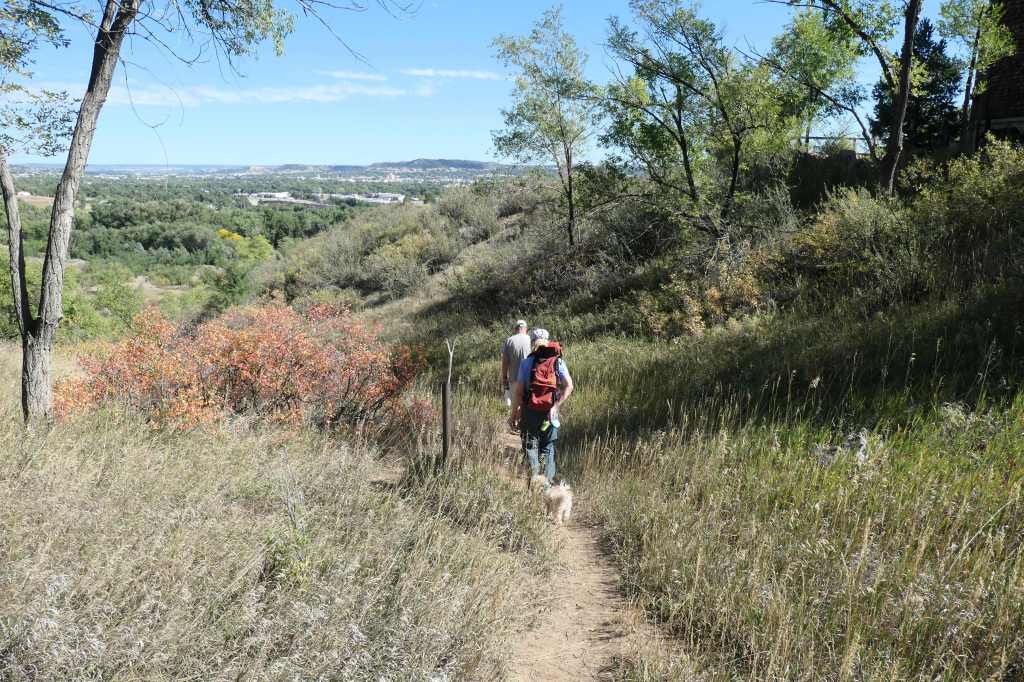
Mochi, not to be outdone, gamely joined us for a “hike” near the house a couple of days later.
Todd, Kim & Mochi on the trail
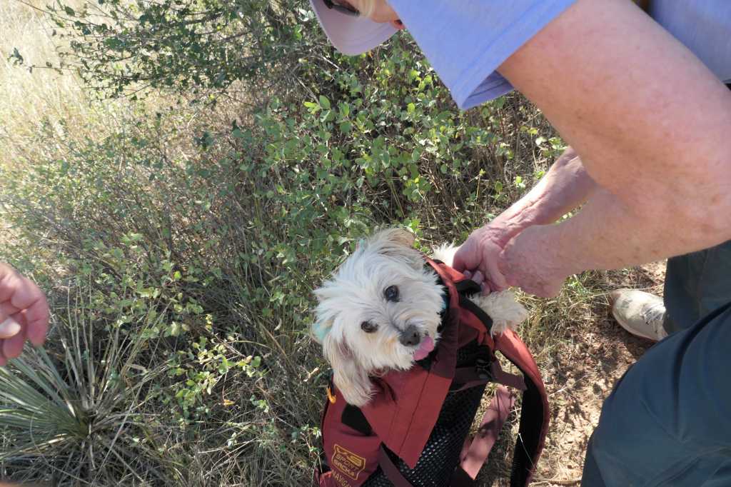
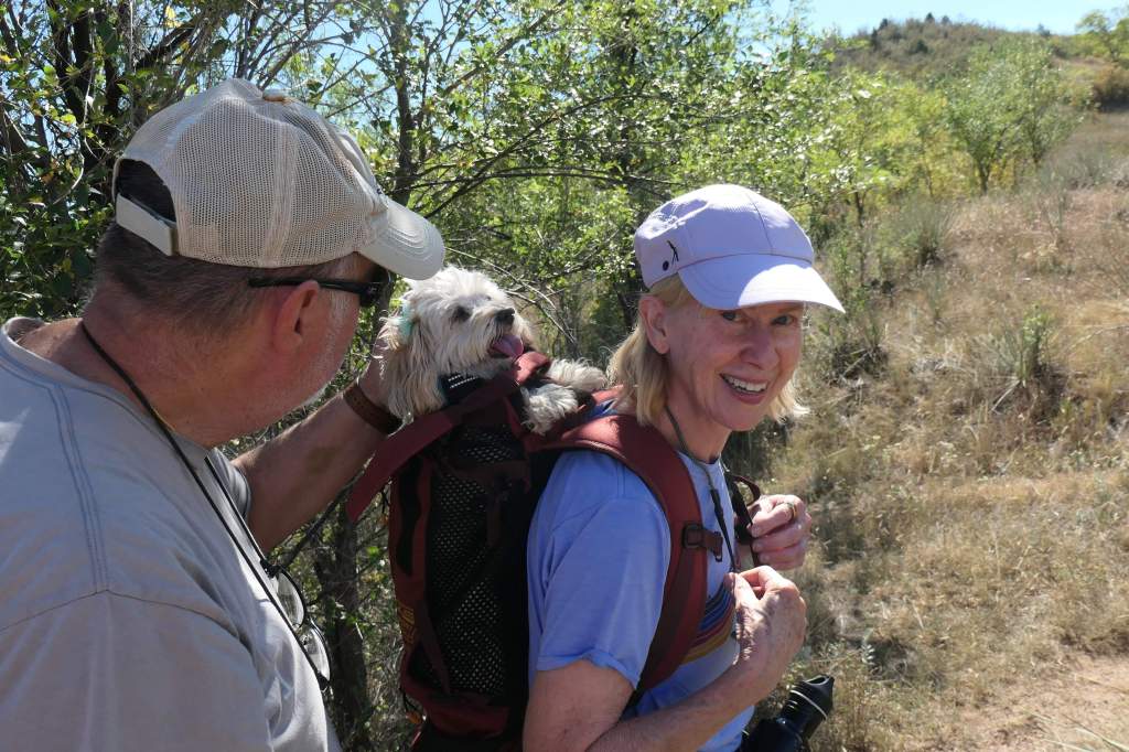
When she got tired, it was time to go… into the backpack
After the somewhat comical “carefully-shove-the-pup-into-the-bag” process, it was all smiles for that plan
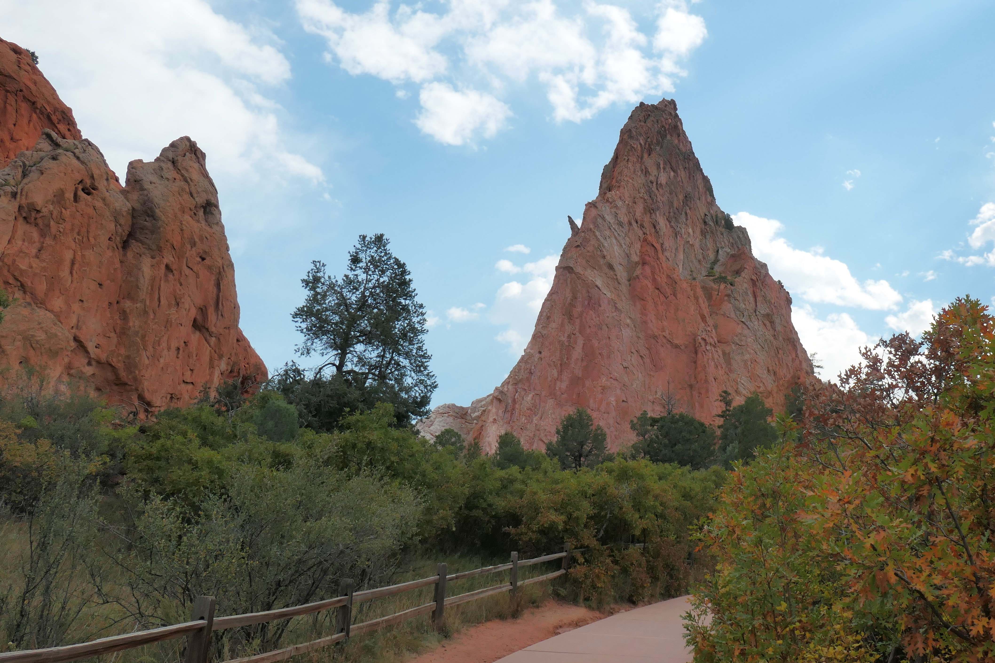
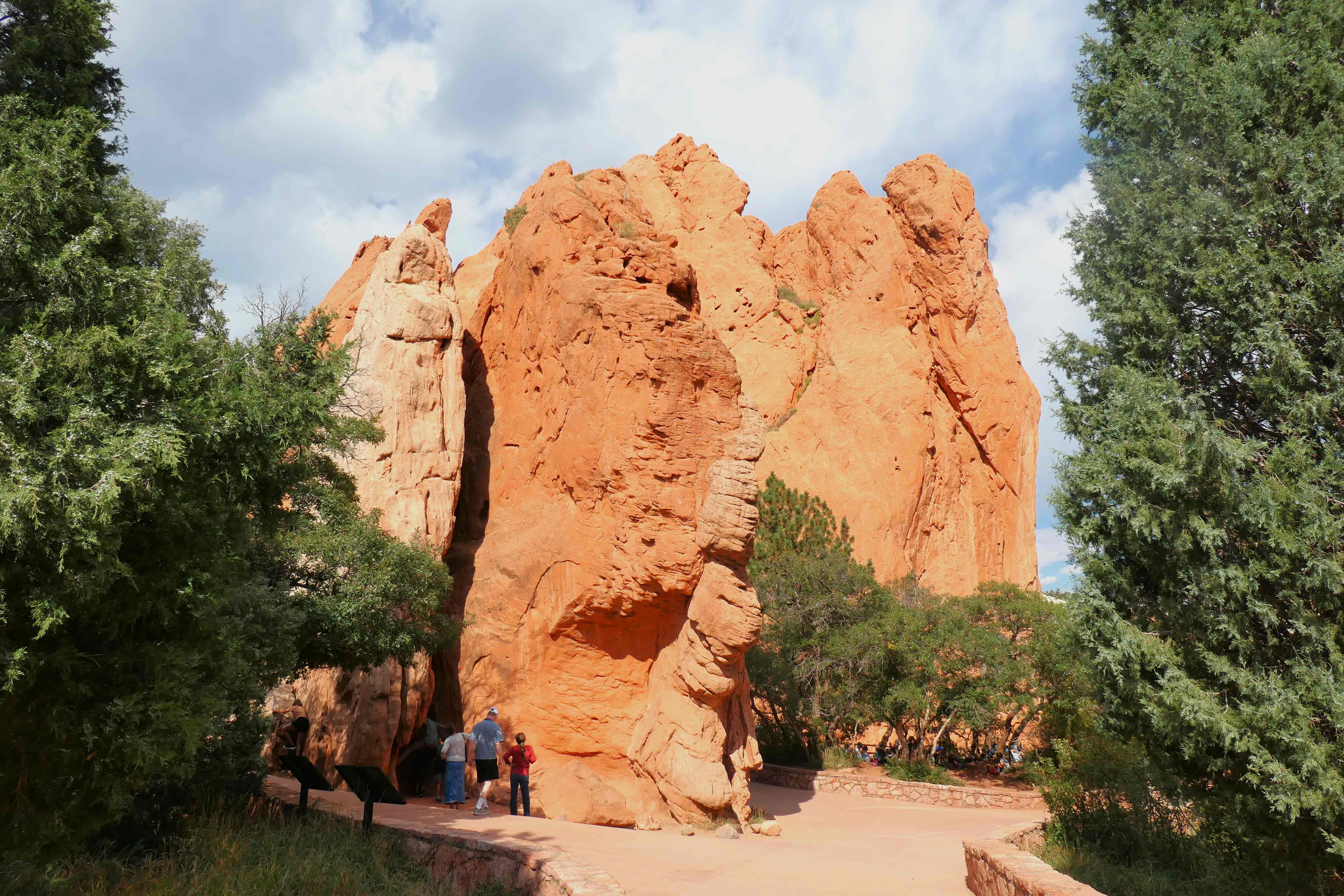
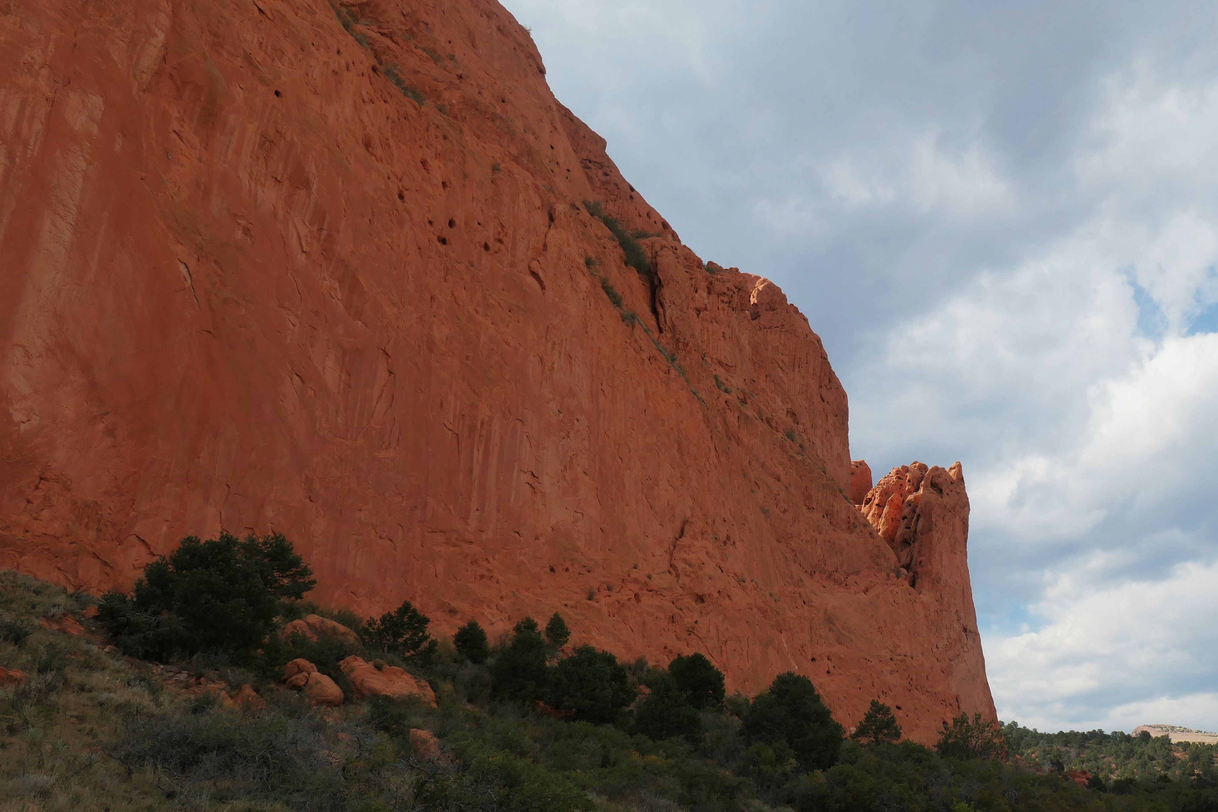
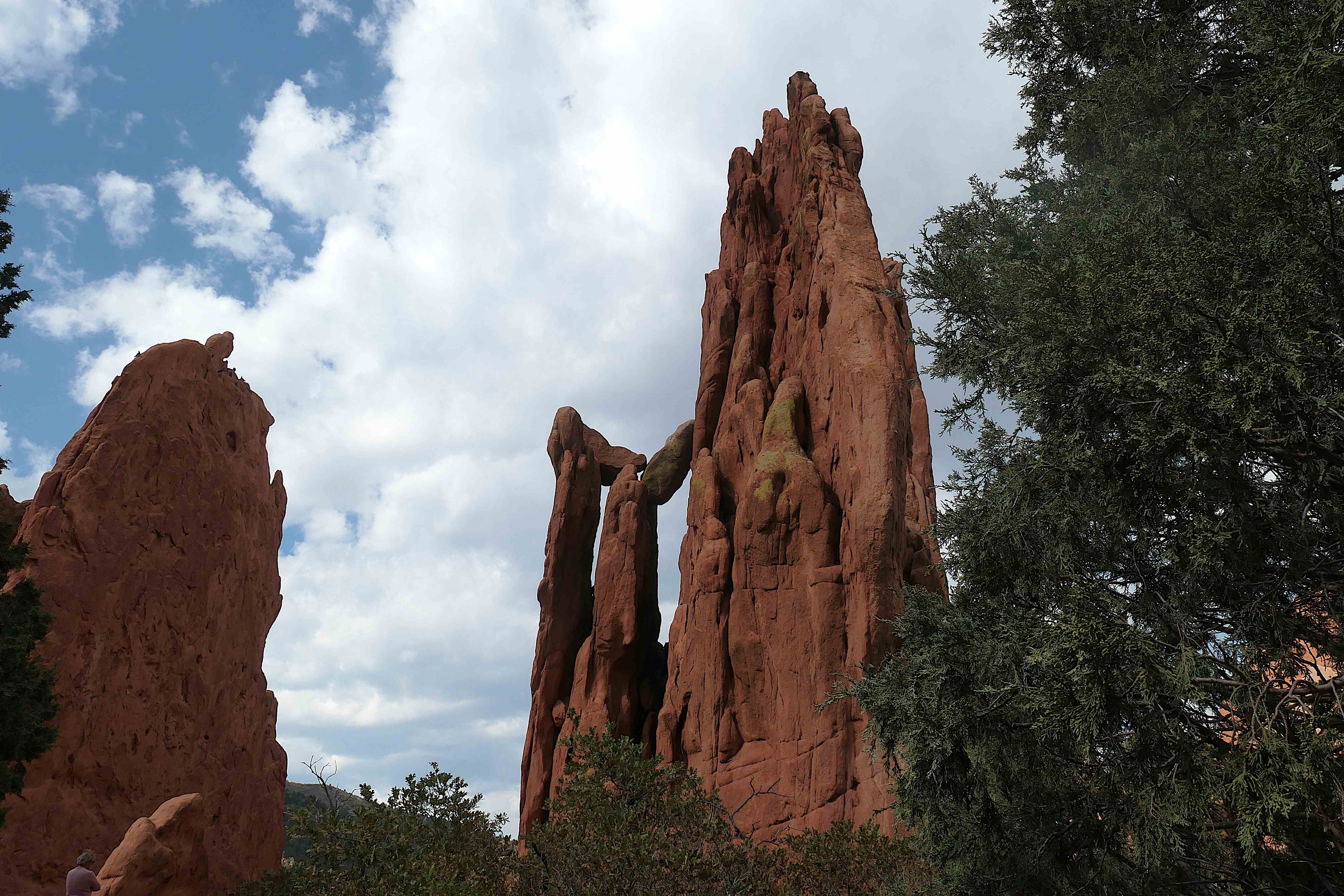
From Kim’s backyard, we could see the standing rocks of the Garden of the Gods in the distance, so we took a ride one afternoon to see them up close. More than 1,300 acres of the prettiest, jagged-ish, rugged-ish stuff around, given to the city of Colorado Springs in 1909 by the children of Charles Elliott Perkins in fulfillment of his wish that it be kept forever free to the public. Wow.
That’s some gift!
Kind of like Mochi. 😉
Thanks, Kim, for sharing your blessings with us and allowing us to care for your home and sweet pooch.
Okay, Todd’s Scandinavian connection explains driving across the top of ND to Minot. But, all “Center” kidding aside, why not keep going another 2.5 hours west before turning south in order to explore all the cool things the Dakotas actually do have to offer? Think, Theodore Roosevelt National Park, Sturgis, Deadwood, the Badlands, Wind Cave National Park, Custer, Mount Rushmore, etc. Heck, that would still be headed towards Colorado, wouldn’t it? What gives? Who failed to plan on that one??
Actually, that’s one of the most wonderful traits of vagabonding. Flexibility! One plan had us spending most of September and October exploring the scenic western Dakotas – hold that thought. However, when we accepted the opportunity in Colorado Springs, we decided we didn’t want to “fly” past all those beautiful spots in the Dakotas, choosing instead to turn a blind eye, i.e. pretend those things aren’t there, and turn due south from Minot for a cruise through the middle.
Since we do know the cool stuff is there, and we have family in ND (Hi, Helen & Bruce!), we will return, hopefully in the spring. For now, though, we had to keep rolling, rolling, rolling!
Spoiler alert: Turns out we made a good choice. Mochi quickly worked her way into our hearts.
Now for the final segment of our flashback tale of the journey from Michigan to Colorado to meet Kim and Mochi.
From where we left off with that nice family run motel in Washburn, ND, it was a two-hour drive through North Dakota cattle country to the South Dakota border. We can attest to seeing the largest (think more than a mile deep by at least 2 1/2 miles long) field of sunflowers these reporters have seen. Pretty!
And then, guess what we found?
Yep. More cattle and hay rolls/bales as far as the eye could see. Seriously, as very far as we could see. Makes one say, holy moly that’s a lot of rolls! And then blip, we were in Nebraska!
It wasn’t really a “blip,” just seemed like it when reviewing photos. There was a six-hour (plus stops) drive, followed by an overnight stop in Winner SD and another long day of driving to the welcome sign into Nebraska and straight on through to North Platte at the bottom of central Nebraska. So, for purposes of our tale, “blip,” we were in Nebraska. 🙂 Seems like we didn’t “like” South Dakota. Not true, it was more like rolling, rolling, rolling!
Our description would include WOW! Hardly a manmade structure to be seen, just miles and miles of gently rolling, dry hills and prairie grass. What a journey it would have been by wagon train.
The land is fairly flat near the borderAnd within an hour or so, the sandhills beginThe sandhills extend for milesIn some areas, the hills are high enough to offer quite a view
Once in southern Nebraska, we stopped in North Platte to tour the Golden Spike Tower for a panoramic view of the world’s largest rail yard – Union Pacific’s Bailey Yard. That’s right, the biggest and it is just remarkable. Two miles wide by eight miles long and always moving stuff through.
Of course, we also toured the museum where we learned this is the halfway point from Denver to Omaha on the Transcontinental railway. The most impressive thing we enjoyed learning about was the Canteen the town established during WWII to serve the daily troop trains. 55,000 volunteers from 125 surrounding towns baked goodies to give to more than 6 million soldiers over 5+ years. The details in the “Canteen” link above will warm your heart. There’s nothing like the power of American volunteerism! And it is so amazing to learn about the good in our country!
From North Platte, we took parts of the Oregon Trail and a bit of the Lincoln Hwy a couple of hours due west to Sidney, Nebraska to rest up for a few days, intending to be at our best when meeting Kim and Mochi in Colorado Springs. (Isn’t that a laugh!)
Plenty of research and forethought goes into each of our upcoming destinations, but our planner also performs last-minute scouting as we travel to ensure we don’t miss something truly interesting a block over while zipping along at 60 mph. In that regard, a funny thing happened in ND. Something like, h-e-y… how about this town claiming to be the “Geographical Center of North America?” Our curiosity piqued, we added a quick photo-op stop in Rugby, ND to our route.
North Dakota is not only one of the least-visited states, it’s also one of the last on a tourist’s bucket list... even the geese just fly right over. And yet, poor, left-out North Dakota may actually be the center of our world.
“… if you can say, ‘I live at the Geographical Center of North America,’ that’s pretty cool!” said Cathy Jelsing… whose job with the Historical Society included pointing wayward tourists to the spot where, since 1931, a stone monument has marked the area claimed to be the Geographical Center of North America.
We found said monument now standing in the parking lot of a Mexican restaurant in the small town of Rugby (pop.~2700)
So, how was it determined that Rugby, ND was the continental bull’s eye? (Get ready for it. This is highly scientific.)
In 1928, an employee with the U.S. Geological Survey took a cardboard cutout of the map of North America with a pin stuck through it and balanced it on his finger. Not the most sophisticated method, perhaps, but for decades few argued with it.
And the town of Rugby it seems embraced it, as it gave them a sense of place.
“You have to understand that here in North Dakota, we don’t have that much,” said Clay Jenkinson, a humanities scholar and North Dakota native. “We don’t have Carnegie Hall. We don’t have the Statue of Liberty. So, this mattered to Rugby. It’s their Grand Canyon. It’s their Teton Mountains. It’s true! This is it!“
Jenkinson blissfully never questioned Rugby’s title, until he learned of Hanson’s Bar, and its owner (Bill Bender), who claimed the center of the continent was actually about a hundred miles south, in the town of Robinson.
Jenkinson was offended, thinking, “Who is this jerk? Why mess with this little town’s one pathetic claim to cosmic fame?'”
The owner of Hanson’s Bar claimed he meant no harm. …it was a simple trivia question that he and a few buddies called into question... admitting that their calculations required “‘lots of trial and error.‘”
One night, armed with a globe, some string, and more than a few beers, they made the case that the continent’s center was – perhaps not so coincidentally – right beneath the bar itself. (Imagine that.)
Bender said, “...what we did late at nightseems far more scientific than a child cutting out a cutout and balancing it!“
Straightaway, Bender checked to see if Rugby had trademarked their precious phrase “Geographical Center,” and they had, but they’d let it lapse. 😦 So, Bender quickly registered everything and paid the $300 to take the phrase. At that point, per the U.S. Patent and Trademark Office, Hanson’s Bar in Robinson ND became the “Geographical Center of North America.”
Can’t make this stuff up! So, we added another photo-op stop to our route.
And we arrived to find the bar in the tiny town of Robinson (pop: ~38) closed for the day.
Per Jelsing back in Rugby, “It wasn’t very nice what they did. If we lost the Geographical Center, what would we be? … just another town in the middle of nowhere.”
Word of the midpoint meltdown soon got around, and Peter Rogerson, a professor in the Geography Department at the University at Buffalo, decided he’d give it a crack.
Rogerson used latitudes and longitudes and, taking the curvature of the earth into account, plugged the continental coordinates into a special algorithm he’d designed to find the true center. The program ran through the numbers and, to his surprise, determined the spot was, indeed, in North Dakota, but this time the center – believe it or not – was near a town actually named Center (pop. ~570).
Again, you can’t make this stuff up!
Two men born and raised in Center (so named because it’s the center of the county), decided they should celebrate the newfound fame just like the other towns had. Finding an ideal site for a marker up on a hill “where you can see forever,” and being fairly confident that this will be the permanent site, they called the coal mine to request “a pretty rock” to mark the spot. Two weeks later, the coal mine lady called to say she’d found them “thirty-thousand pounds of permanence.”
You know it; another photo-op stop. We’d become fairly committed to being centered.
The marker is just outside the town of CenterTodd signed the guestbook before we walked out to the rockOkay; so, now this is it?You can seemingly see forever from the top of the hill
As for Hanson’s Bar in Robinson? …Bill Bender backed down and gave the Geographical Center trademark back to Rugby, although he’s still not removing the decal on the floor.
Asked, “What do you think this controversy says about North Dakota,” Clay Jenkinson replied, “It says we’re a loser state! I mean, it’s in the same zone as the World’s Largest Ball of Twine, what we’re talking about here. This is about something of no consequence, really, that sort of has a level of absurdity right at the center of it. And if it helps North Dakota, even in a puny little way, I’m for it!”
His advice: Chase after the centers while you can. Continents do wander, after all!
The Olsens, having covered an additional 100 miles in search of center, decided we could take our successfully focused, relaxed selves and move on. See you later, North Dakota!
As for our flashforward, how about this? Football has centers, right? Ha!
You better get home, Kim. There’s a flag on the play: we’re converting Mochi into a Falcons fan!
Whew, Isle Royale National Park was beautiful and fun all at once. But now we needed to head to Colorado Springs for our pet-sitting date with Kim and Mochi.
First step, back down Michigan’s Keweenaw Peninsula to pick up U.S. 2 in Wisconsin, adding a side trip along the Apostle Islands National Lakeshore, heading to Duluth, Minnesota. Yup, Todd wanted to travel US 2!
Along the way, we swung by to see what’s left of the Old Globe Grain Elevator in Superior, Wisconsin. Why? Todd. He read it used to be one of the largest fully wooden grain elevators ever built and after 130 years and several fires, it finally succumbed to one. Hopefully, what’s left will continue to be recycled into flooring and all other things wood.
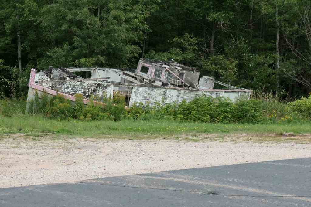
Speaking of wood, also along the road, Todd found a wooden boat he declared to be a viable “fixer upper.” 🙂
Remains of the Old Globe Grain ElevatorFirst mate declared a hard pass
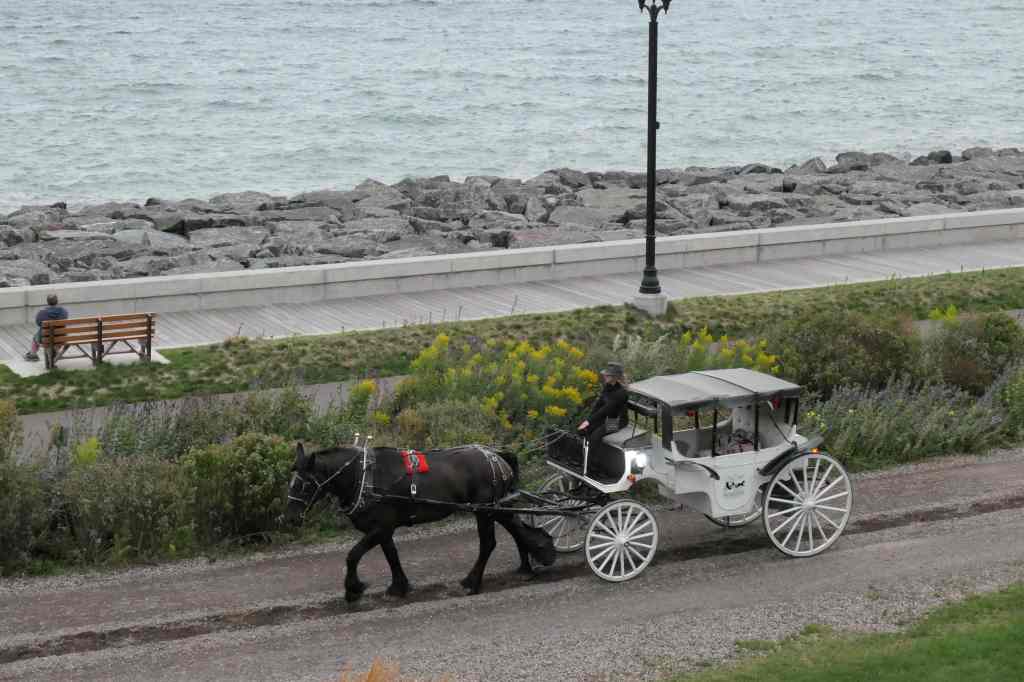
Just around the corner from this historic area, we stopped for the night at The Inn on Lake Superior, tag lined, “If you were any closer to the lake, you’d be in it.” From our third-floor balcony, we watched the downtown carriages return to the barn before a storm came in across the lake. In the morning, we had a great view of cruisers getting underway at sunrise.
Duluth/Superior is the westernmost point of the biggest Great Lake that was the central point of moving zillions of tons of stuff (highly technical stat there) from the MidWest to the rest of the country and the world! And we could only stay one night, bummer.
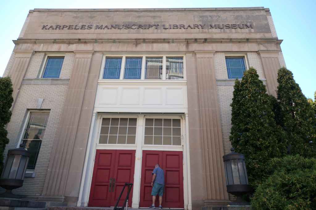
In the morning, we visited the interesting Karpeles Manuscript Library Museum for a quick look around before making the 500-mile drive from Duluth to Minot, North Dakota. Say what? But, on the way…
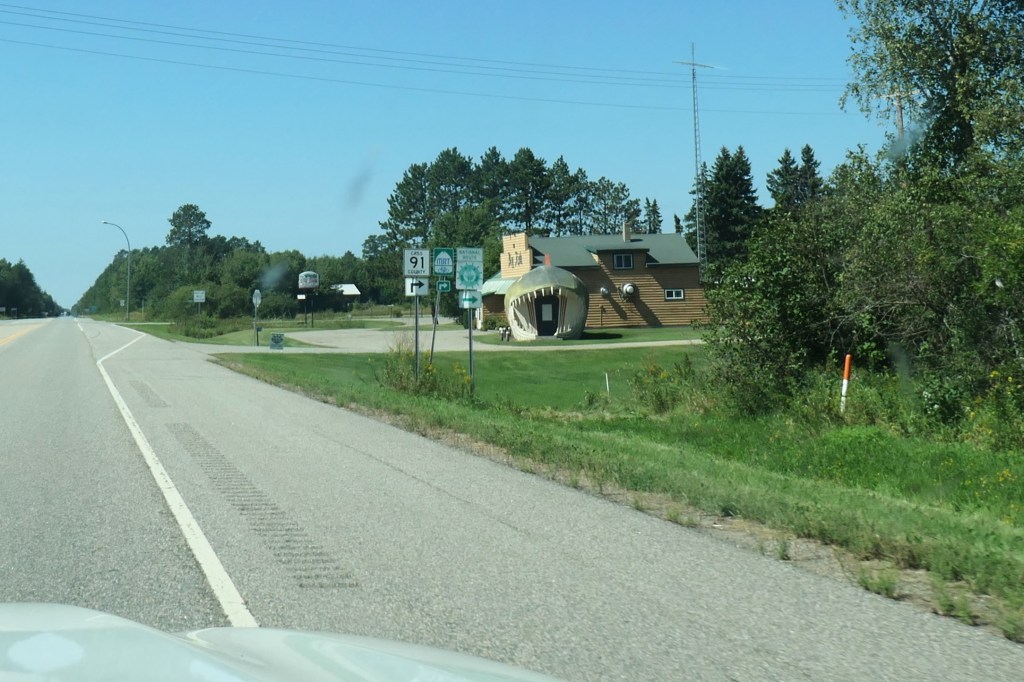
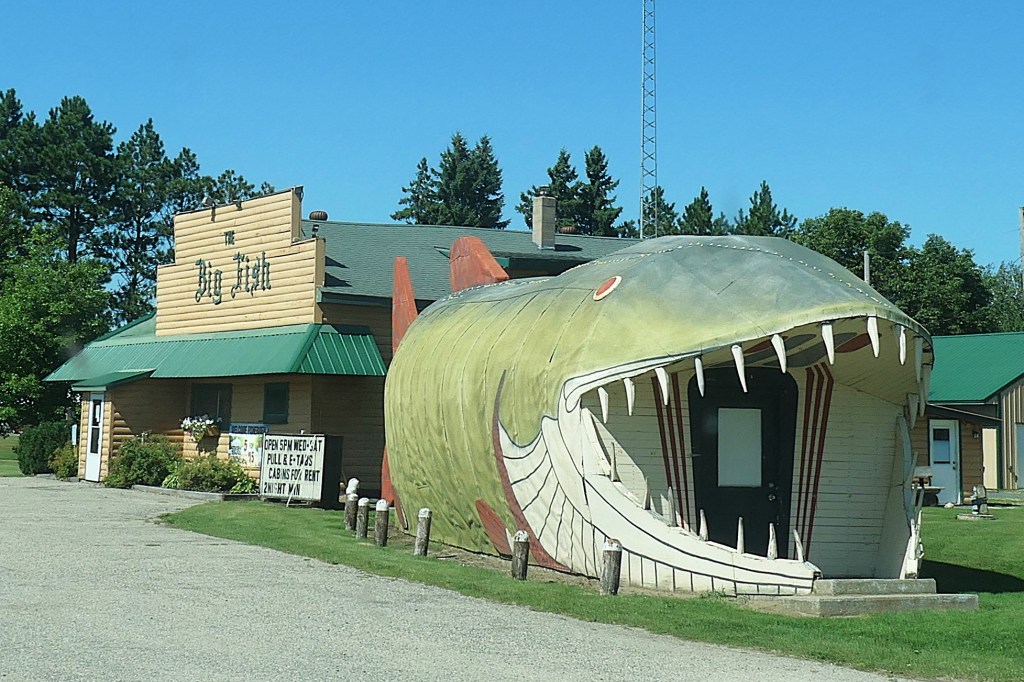
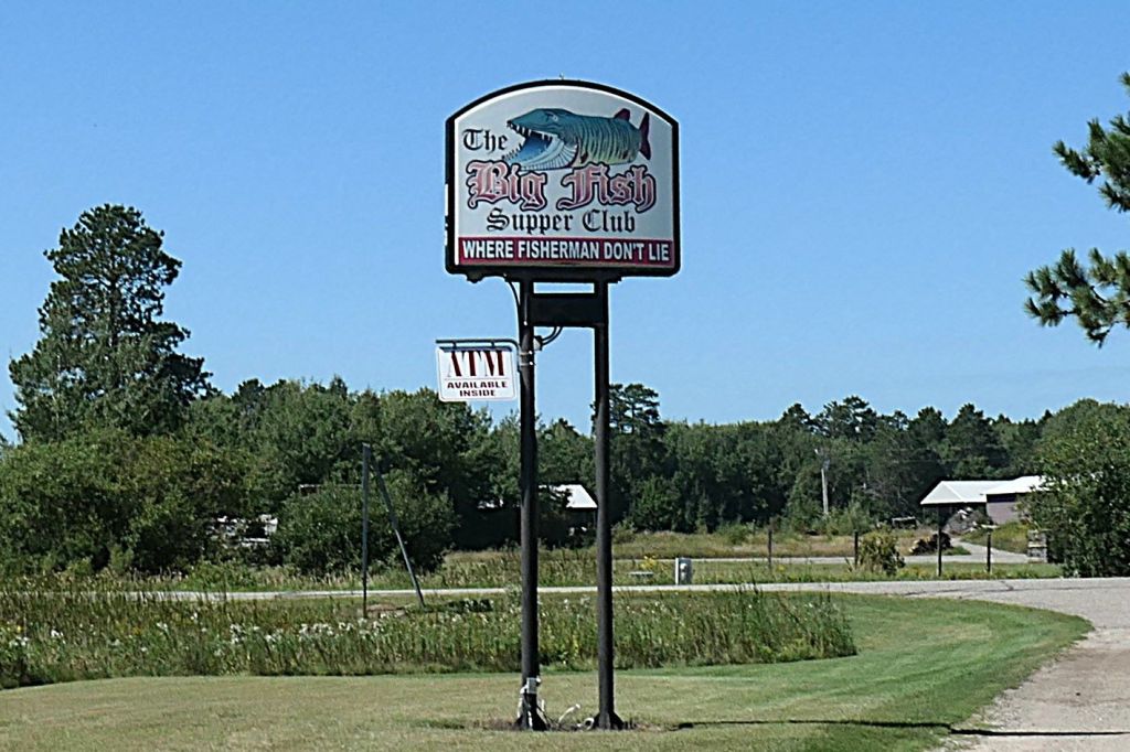
We did have a planned stop at Itasca State Park in Minnesota to see the actual headwaters of the mighty Mississippi River! On the way, Susie kept trying to get a good shot of one of the Great River Road signs through the bug-splattered windshield. In one instance, she checked the tiny screen afterwards to see she’d captured… teeth?
Huh?
Time for a U-turn
The Big Fish Supper Club seemed like a hoot, but it wasn’t open & we had to keep moving!
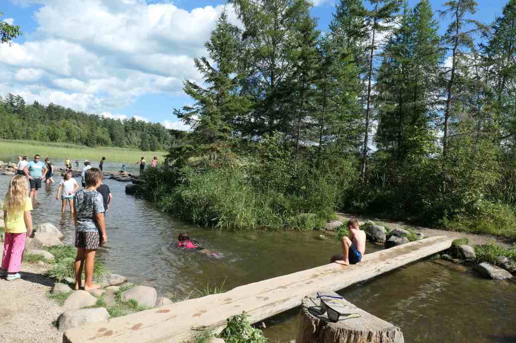
Established in 1891, Itasca State Park is Minnesota’s oldest state park and, more importantly to us, features the headwaters of the Mississippi River. You know we had to check that out.
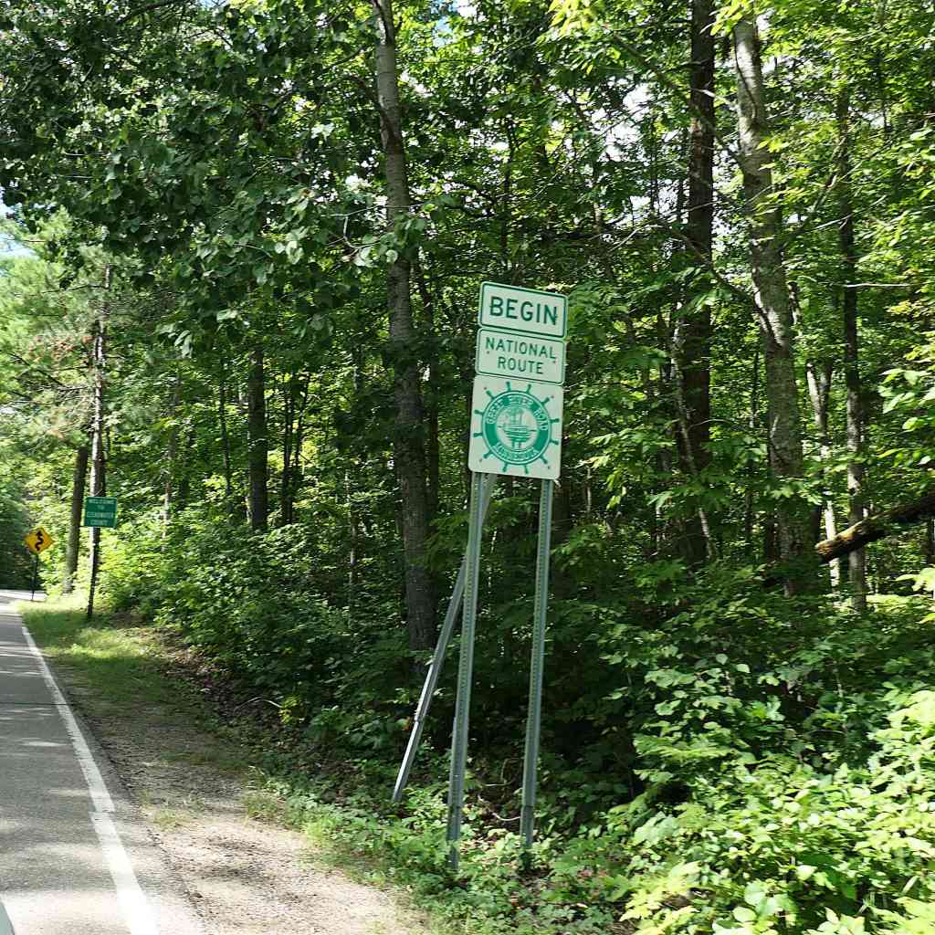
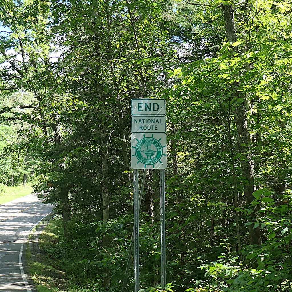
The 3,000-mile Great River Road National Scenic Byway begins within the park.
And if you turn your head when passing the “Begin” sign, the sign for the “End” of the circle is in the other lane.
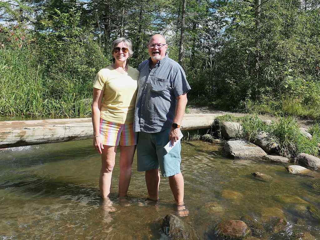
We, however, side tripped to Itasca not for the scenic drive through the park but to wet our feet in the actual start of the Mississippi! Here 1475 feet above the ocean, the mighty Mississippi begins to flow north on its winding way to the Gulf of Mexico. Wait. North? Yes, north; not a misprint. The small (at this point) river first flows north from Lake Itasca, makes a bend to the east, and then begins flowing south, essentially making a U-turn, gaining size all the way along its 2552 miles to the Gulf.
Throngs of visitors enjoying the beautiful dayYep. That’s it – ankle deep
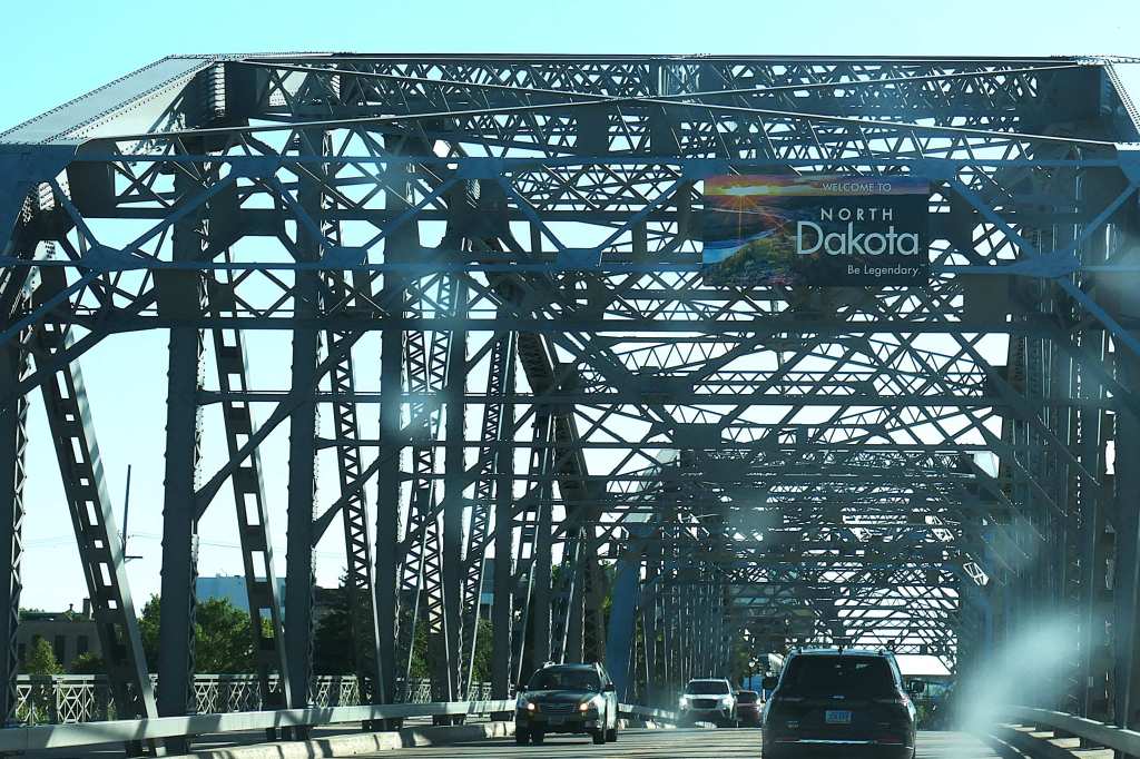
After splashing in the Mississippi, it was back on the road, rolling, rolling, rolling through the rest of northern Minnesota on to North Dakota for a quick stop for the night on the edge of ND in Grand Forks.
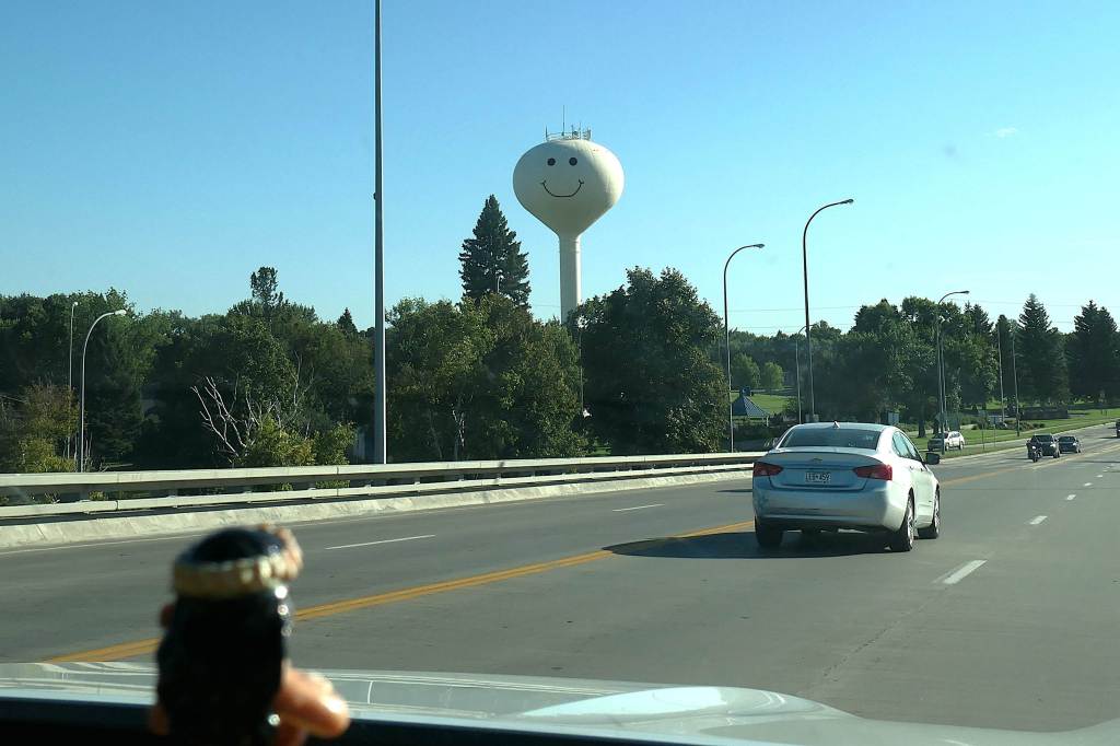
Grand Forks seems friendly
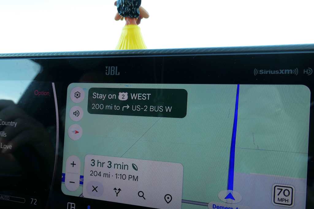
In the morning, we quickly moved on to Minot, North Dakota, along the north and about midway across the state.
The directions were certainly clear enough… rolling, rolling, rolling…
But why Minot (pronounced mynot)?
Apparently, there’s a joke among Air Force members about Minot, which isn’t generally high on the list of dream assignments. The joke goes, “Why not Minot?” “Freezin’s the reason.”
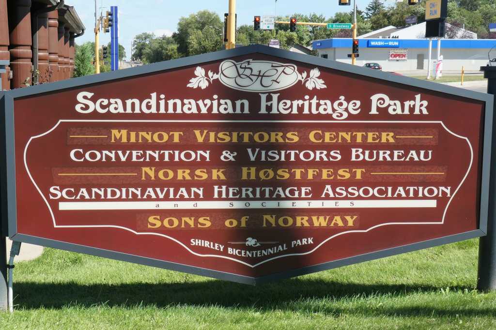
Being Olsens, we traveled to Minot specifically to visit the Scandinavian Heritage Park.
Established in 1988, the park celebrates and preserves Nordic architecture and represents the five Scandinavian and Nordic countries of Norway, Sweden, Finland, Denmark and Iceland. The first three are important to Todd’s heritage.
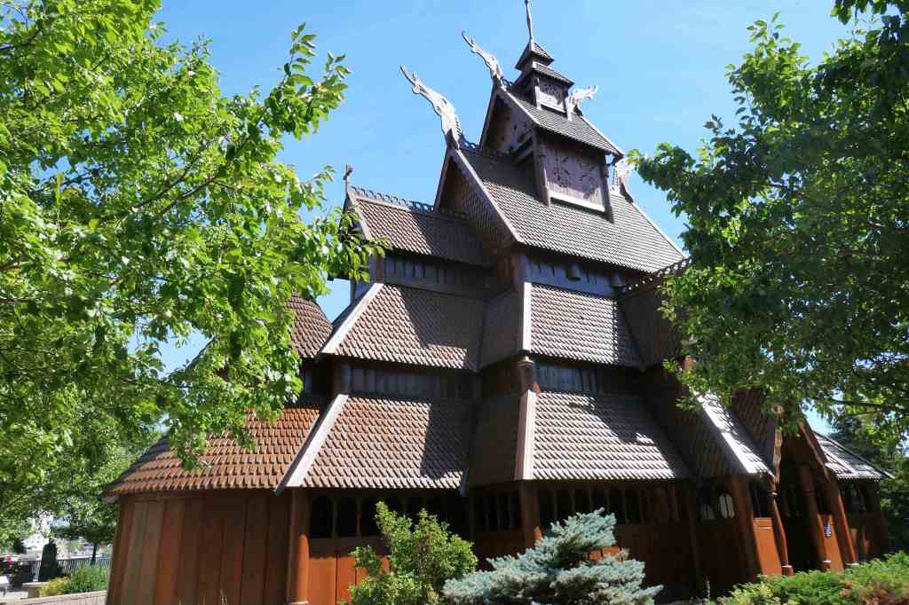
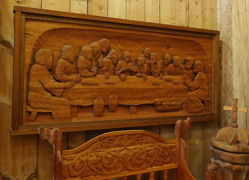
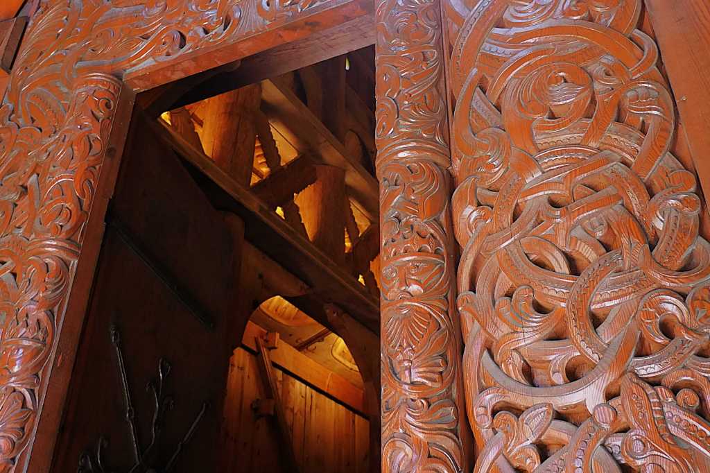
Along with the gorgeous Gol Stave Church, our other favorite areas proved to be larger than life.
Unsure of his exact heritage, Todd opted to put himself between Norway & SwedenWhile Susie naturally gravitated toward the 30-foot-tall Swedish Dala horse
After our afternoon in the park, it was time to find the hotel we’d booked for the night, an hour due south in Garrison, which turned out to be a bust when they played a bit of shuck and jive with the rate during check-in, doubling it from what we’d reserved months before. We firmly but politely declined… with no Plan B. Lesson learned – if you walk away, you have to be very flexible when searching for alternative lodging in the middle of farm country!
We ended up 35 miles south in Washburn, where we found a small but clean mom and pop motel just a block off the main road. No free breakfast like the chain hotels, but there was a fairly priced diner conveniently located across the parking lot. Score for the weary travelers!
Now for our flashback to the present and taking care of the precious Mochi, here you go, Kim. Mochi says hello.